USGS Water Resources(@USGS_Water) 's Twitter Profileg
USGS Water Resources

@USGS_Water

Observing, understanding, predicting, delivering #WaterScience
💧Comment policy: https://t.co/fdMZuJnkZx
💧Posts do not=endorsements https://t.co/SEG5ZFX36x

ID:717107602203607040

linkhttps://www.usgs.gov/mission-areas/water-resources calendar_today04-04-2016 21:52:30

4,5K Tweets

6,9K Followers

58 Following

USGS(@USGS) 's Twitter Profile Photo

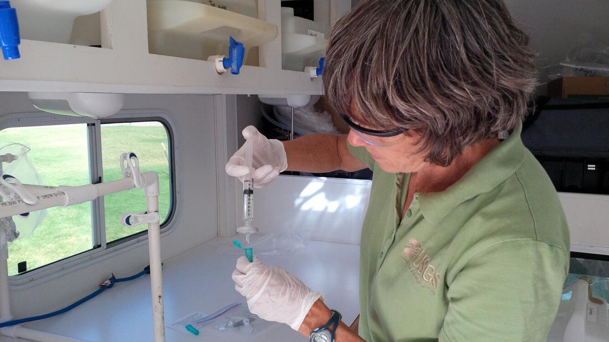
No one wants mystery chemicals in their water supply. At USGS, we study the occurrence, movement, and sources of contaminants in different sources of drinking water to provide critical information.

Learn more: ow.ly/Y6zB50RyZRN

No one wants mystery chemicals in their water supply. At USGS, we study the occurrence, movement, and sources of contaminants in different sources of drinking water to provide critical information. Learn more: ow.ly/Y6zB50RyZRN #DrinkingWaterWeek
account_circle
USGS Data Science(@USGS_DataSci) 's Twitter Profile Photo

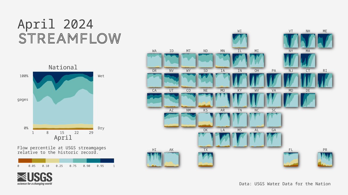
April  conditions across the U.S. 💧

Storm systems brought wet conditions to much of the Midwest and Northeastern U.S.

 made with 

github.com/DOI-USGS/flow-…

April #streamflow conditions across the U.S. 💧 Storm systems brought wet conditions to much of the Midwest and Northeastern U.S. #DataViz made with #rstats #dataRetrieval github.com/DOI-USGS/flow-…
account_circle
USGS Water Resources(@USGS_Water) 's Twitter Profile Photo

The protects our public water supply and this week we are celebrating . Learn how USGS protects your drinking water: usgs.gov/programs/envir…
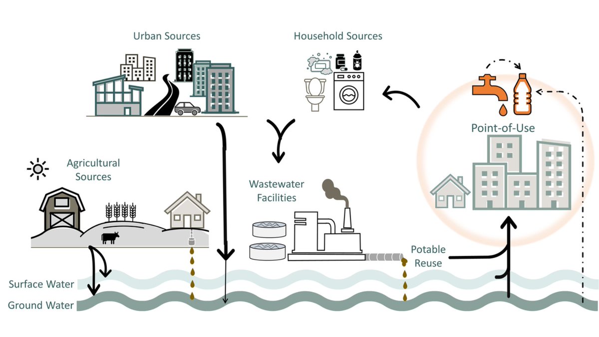
The #SafeDrinkingWaterAct protects our public water supply and this week we are celebrating #DrinkingWaterWeek. Learn how @USGS protects your drinking water: usgs.gov/programs/envir…
account_circle
USGS Water Resources(@USGS_Water) 's Twitter Profile Photo

It's !

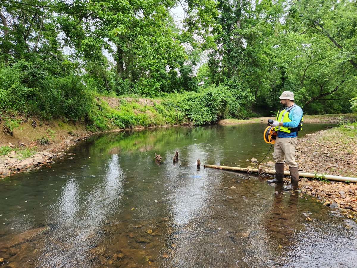
A USGS hydrotech uses a water quality sonde to measure conditions at Accotink Creek Near Annandale, VA.

Get the data: waterdata.usgs.gov/monitoring-loc…

📸 Rowan Johnson, USGS

It's #FieldPhotoFriday! A @USGS hydrotech uses a water quality sonde to measure conditions at Accotink Creek Near Annandale, VA. Get the data: waterdata.usgs.gov/monitoring-loc… 📸 Rowan Johnson, USGS
account_circle
USGS Water Resources(@USGS_Water) 's Twitter Profile Photo

Hydrology fan: I lay in bed at night wondering about the effect that groundwater seepage has on stream temperature...

Us: Hey fan, circulate this video around
usgs.gov/media/videos/h…

account_circle
USGS Water Resources(@USGS_Water) 's Twitter Profile Photo

Chaco Culture NHP is important to many indigenous peoples. Through our National Park Service partnership, we assessed the vulnerability of a crucial water resource: the park's only drinking water well. We discovered changes in water quality. Read about it:  webapps.usgs.gov/nps-partnershi…
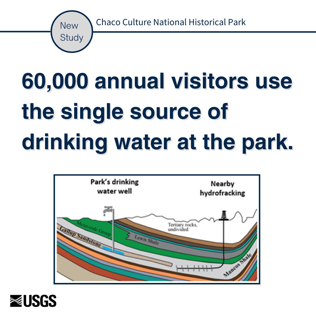
Chaco Culture NHP is important to many indigenous peoples. Through our @NatlParkService partnership, we assessed the vulnerability of a crucial water resource: the park's only drinking water well. We discovered changes in water quality. Read about it:  webapps.usgs.gov/nps-partnershi…

account_circle
USGS Data Science(@USGS_DataSci) 's Twitter Profile Photo

Join the challenge to forecast river chlorophyll with EFI-USGS River Chlorophyll Forecasting Challenge co-hosted by Ecological Forecasting Initiative and USGS Water Resources! Sharpen your skills & contribute to vital research!


Read more: waterdata.usgs.gov/blog/habs-fore…

Join the challenge to forecast river chlorophyll with EFI-USGS River Chlorophyll Forecasting Challenge co-hosted by @eco4cast and @USGS_Water! Sharpen your skills & contribute to vital research! #HABs #Forecasting #WDFN #WaterData #OpenScience Read more: waterdata.usgs.gov/blog/habs-fore…
account_circle
USGS Water Resources(@USGS_Water) 's Twitter Profile Photo

It's !

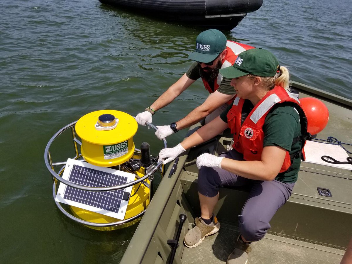
USGS scientists deploy a monitoring buoy at Lake Hopatcong, New Jersey, to monitor water-quality conditions and a harmful algal bloom in near real-time.

Recent HABS research: usgs.gov/mission-areas/…

📸 Brad Bjorklund

It's #FieldPhotoFriday! @USGS scientists deploy a monitoring buoy at Lake Hopatcong, New Jersey, to monitor water-quality conditions and a harmful algal bloom in near real-time. Recent HABS research: usgs.gov/mission-areas/… 📸 Brad Bjorklund
account_circle
USGS National Uncrewed Systems Office (NUSO)(@USGS_UAS) 's Twitter Profile Photo

USGS National Innovation Center engineers are developing the Saucer Shark, an out-of-this-world payload designed to collect high resolution, low noise, airborne magnetic data for critical mineral detection and assessment studies.

👽 Learn more:
usgs.gov/centers/nation…

USGS National Innovation Center engineers are developing the Saucer Shark, an out-of-this-world #UAS payload designed to collect high resolution, low noise, airborne magnetic data for critical mineral detection and assessment studies. 👽 Learn more: usgs.gov/centers/nation…
account_circle
USGS(@USGS) 's Twitter Profile Photo

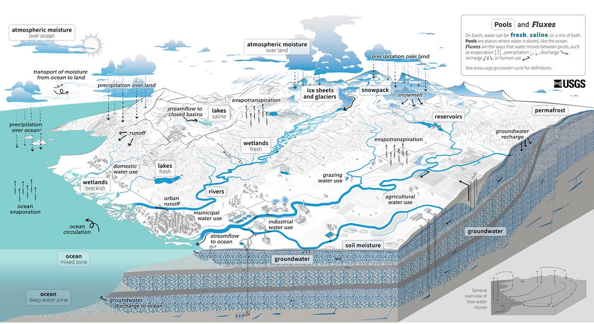
Water fundamentally shapes our world as it cycles across the globe. But what about human impacts on the water cycle? Our newest diagram incorporates human use into the global water cycle. Find it in four languages: ow.ly/1ubf50RntFb

Cycle

Water fundamentally shapes our world as it cycles across the globe. But what about human impacts on the water cycle? Our newest diagram incorporates human use into the global water cycle. Find it in four languages: ow.ly/1ubf50RntFb #EveryDayIsEarthDay #WaterCycle #Water
account_circle
USGS Water Resources(@USGS_Water) 's Twitter Profile Photo

The USGS is using small drones to measure stream discharge safely and rapidly over a wide range of conditions, including high-flow and storm events. Innovates

The USGS is using small drones to measure stream discharge safely and rapidly over a wide range of conditions, including high-flow and storm events. #USGSInnovates #NGWOS #Hydrology #ResearchAndDevelopment #USGS
account_circle
USGS Water Resources(@USGS_Water) 's Twitter Profile Photo

You don't want to miss this speaker line up. Dive into water monitoring technologies with us!

Join live: uasystem.zoom.us/j/82636035295

account_circle
USGS Data Science(@USGS_DataSci) 's Twitter Profile Photo

U.S. River Conditions from January 1, 2024 to March 31, 2024 at USGS 💧

River conditions range from driest conditions at a gage (red open circles) to the wettest (blue closed circles). A purple outer ring indicates flooding.

usgs.gov/media/videos/u…

account_circle