USGS(@USGS) 's Twitter Profileg
USGS

@USGS

Science is only a tweet away. Tweets do not = endorsement: https://t.co/VoRuucTNuK

ID:14505838

linkhttp://usgs.gov calendar_today24-04-2008 03:10:57

27,1K Tweets

798,6K Followers

83 Following

Follow People
USGS(@USGS) 's Twitter Profile Photo

🏊You might joke that Olympic swimmers like Michael Phelps learned to swim before they walked, but that’s literally the case with frogs.🐸 Oregon spotted frogs are particularly aquatic & USGS scientists recognize this in studies of these . 🔍

🏊You might joke that Olympic swimmers like Michael Phelps learned to swim before they walked, but that’s literally the case with frogs.🐸 Oregon spotted frogs are particularly aquatic & USGS scientists recognize this in studies of these #FantasticFrogs. 🔍 #AmphibianWeek2024
account_circle
USGS(@USGS) 's Twitter Profile Photo

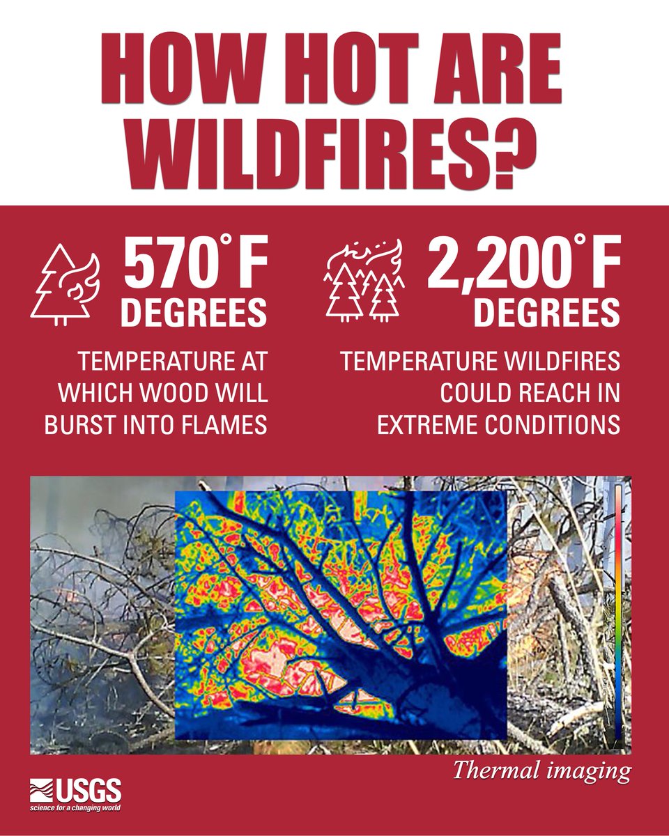
Were you ever curious about how hot wildfires get? Wildfires often range between 1,200 degrees and 2,000 degrees Fahrenheit, with some extreme conditions driving temperatures over 2,200 degrees Fahrenheit. That is about 1/5 the temperature of the sun.

Were you ever curious about how hot wildfires get? Wildfires often range between 1,200 degrees and 2,000 degrees Fahrenheit, with some extreme conditions driving temperatures over 2,200 degrees Fahrenheit. That is about 1/5 the temperature of the sun. #WildfireAwarenessMonth
account_circle
USGS(@USGS) 's Twitter Profile Photo

Happy !

During the 1960's & 70's, we were part of one of the most remarkable events and history of mankind—the manned Apollo expeditions to the Moon!

USGS Astrogeology


📸 Harrison 'Jack' Schmitt with U.S. flag, NASA
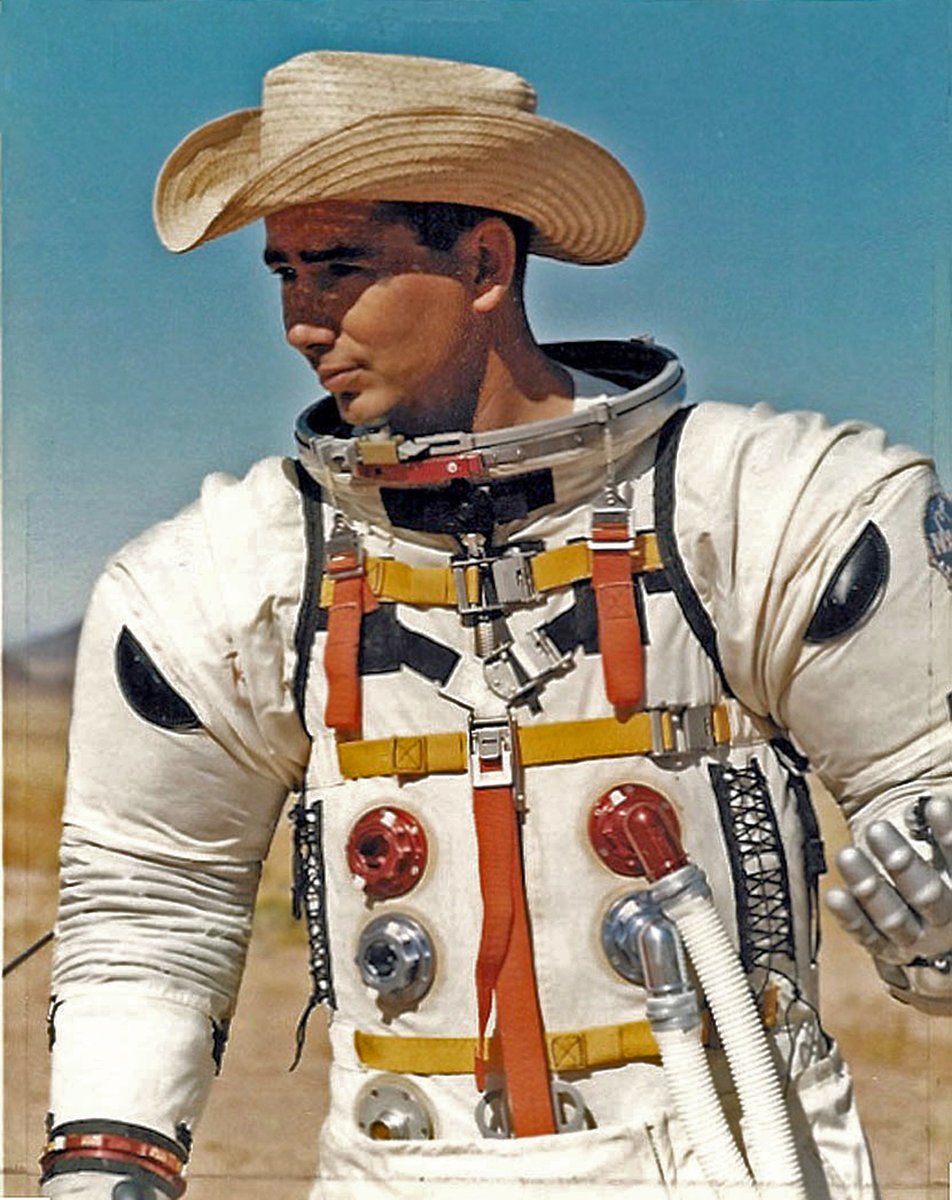
Happy #NationalSpaceDay! During the 1960's & 70's, we were part of one of the most remarkable events and history of mankind—the manned Apollo expeditions to the Moon! @USGS_AstroGeo #PlanetaryScience #Apollo #Astrogeology #Moon 📸 Harrison 'Jack' Schmitt with U.S. flag, NASA
account_circle
USGS(@USGS) 's Twitter Profile Photo

Recent investments are clearing the way for USGS and US Department of the Interior scientists to study previously unaddressed aspects of wildland fire management including…well, click the link to find out 😊 ow.ly/wtkh50RvgeP.
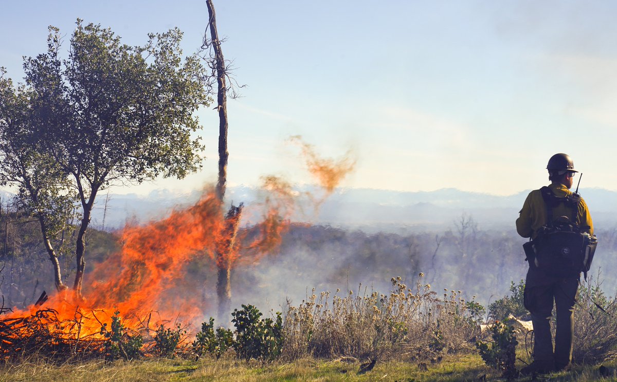
Recent #BipartisanInfrastructureLaw investments are clearing the way for USGS and @Interior scientists to study previously unaddressed aspects of wildland fire management including…well, click the link to find out 😊 ow.ly/wtkh50RvgeP.
account_circle
USGS in Idaho(@USGS_Idaho) 's Twitter Profile Photo

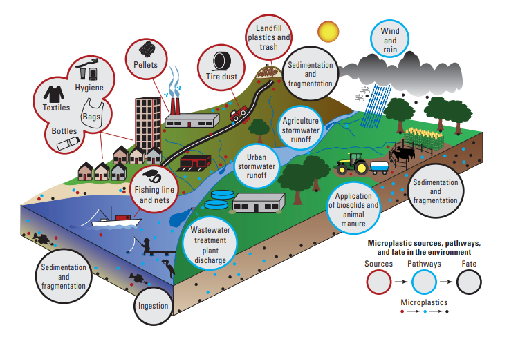
A new publication from the USGS identifies current science gaps and prioritizes research relevant to the mission, expertise, and capabilities of the . -based research hydrologist Austin Baldwin is a co-author. doi.org/10.3133/cir1521

A new publication from the @USGS identifies current #microplastic science gaps and prioritizes research relevant to the mission, expertise, and capabilities of the #USGS. #Boise-based research hydrologist Austin Baldwin is a co-author. doi.org/10.3133/cir1521
account_circle
USGS(@USGS) 's Twitter Profile Photo

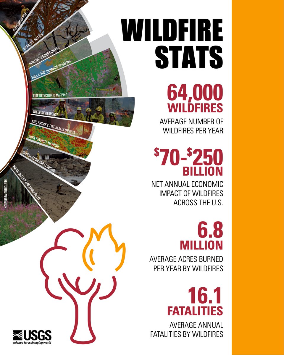
Wildfires are expensive & impact many people’s lives. Here are some annual wildfire stats that put their prevalence in perspective. What stat stands out to you? Comment below. ow.ly/b2H850RsVsk

Wildfires are expensive & impact many people’s lives. Here are some annual wildfire stats that put their prevalence in perspective. What stat stands out to you? Comment below. ow.ly/b2H850RsVsk #WildfireAwarenessMonth
account_circle
USGS(@USGS) 's Twitter Profile Photo

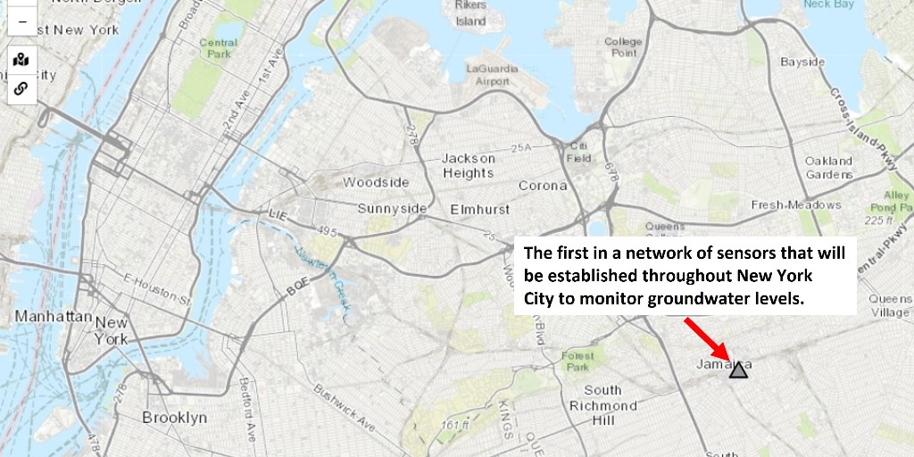
The USGS recently installed the first in a network of sensors to be established throughout to monitor levels in real time. Insight can help inform city officials as they develop resiliency & mitigation plans. NYC Water York College CUNY

The USGS recently installed the first in a network of sensors to be established throughout #NewYorkCity to monitor #groundwater levels in real time. Insight can help inform city officials as they develop #flood resiliency & mitigation plans. @NYCWater @YorkCollegeCUNY #Science
account_circle
USGS(@USGS) 's Twitter Profile Photo

USGS crews in , , , , and are measuring recent . This critical data can help protect life and property and is used by the National Weather Service to develop flood forecasts and the U.S. Army Corps of Engineers to manage flood control.

USGS crews in #Texas, #Missouri, #Illinois, #Iowa, and #Idaho are measuring recent #flooding. This critical data can help protect life and property and is used by the National Weather Service to develop flood forecasts and the U.S. Army Corps of Engineers to manage flood control.
account_circle
USGS(@USGS) 's Twitter Profile Photo

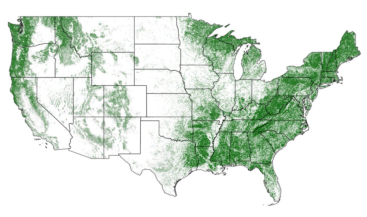
Planting a tree for ? Our satellites are mapping trees nationwide 🌳 to aid land cover research. This canopy data from USDA Forest Service with images is just one layer on the National Land Cover Database supporting environmental research: mrlc.gov/viewer/ 🛰️

Planting a tree for #ArborDay? Our satellites are mapping trees nationwide 🌳 to aid land cover research. This canopy data from @forestservice with #Landsat images is just one layer on the National Land Cover Database supporting environmental research: mrlc.gov/viewer/ 🛰️
account_circle