Chris Bailey🌪️🌩️(@Kentuckyweather) 's Twitter Profileg
Chris Bailey🌪️🌩️

@Kentuckyweather

WKYT Chief Meteorologist. I'm a UK, Reds and Bengals kinda guy. #BBN #WhoDey

ID:28221645

linkhttps://kyweathercenter.com/ calendar_today01-04-2009 23:08:33

160,5K Tweets

120,9K Followers

2,7K Following

NWS Paducah, KY(@NWSPaducah) 's Twitter Profile Photo

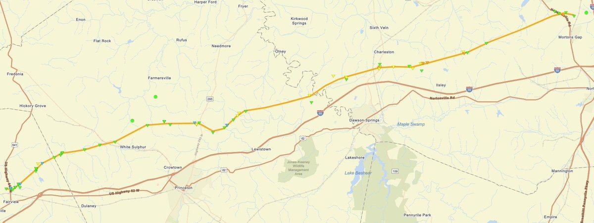
Damage associated with the Interstate 69 tornado in western Kentucky has been assessed as EF-3 (160 mph). Additional refinements to this are possible.

The damage path was 35.4 miles long, 700 yards wide at its peak and it was on the ground for 2 hours and 14 minutes.

Damage associated with the Interstate 69 tornado in western Kentucky has been assessed as EF-3 (160 mph). Additional refinements to this are possible. The damage path was 35.4 miles long, 700 yards wide at its peak and it was on the ground for 2 hours and 14 minutes.
account_circle
Daniel Smith(@ukfandan37) 's Twitter Profile Photo

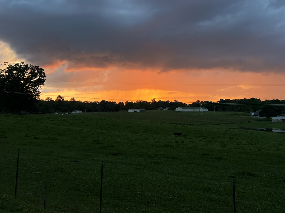
That Storm Sunday was HORRIBLE! I just now got my power and internet back on about 30 minutes ago. Here’s a few picks I took that was from around our area. Chris Bailey🌪️🌩️
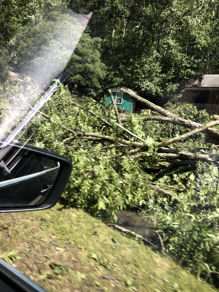
That Storm Sunday was HORRIBLE! I just now got my power and internet back on about 30 minutes ago. Here’s a few picks I took that was from around our area. @Kentuckyweather
account_circle
Waco Kid(@WacoKidKY) 's Twitter Profile Photo

Chris Bailey🌪️🌩️ damage at Lake Reba Little League park in Richmond from the storm Sunday night.
That’s a concrete block dugout flipped backwards
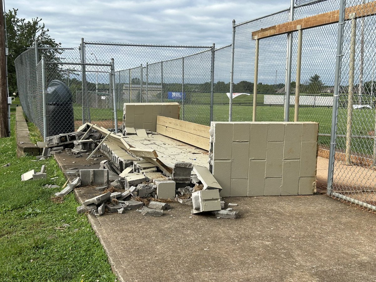
@Kentuckyweather damage at Lake Reba Little League park in Richmond from the storm Sunday night. That’s a concrete block dugout flipped backwards
account_circle
Chris Bailey🌪️🌩️(@Kentuckyweather) 's Twitter Profile Photo

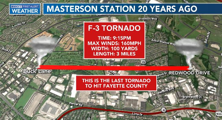
20 years ago tonight, Lexington was rocked by an F-3 tornado that touched down in the Masterson Station area. There was no tornado warning.

This is also the last tornado to touch down in Lexington, making this our longest period in recorded history without a tornado.

20 years ago tonight, Lexington was rocked by an F-3 tornado that touched down in the Masterson Station area. There was no tornado warning. This is also the last tornado to touch down in Lexington, making this our longest period in recorded history without a tornado. #kywx
account_circle
Chris Bailey🌪️🌩️(@Kentuckyweather) 's Twitter Profile Photo

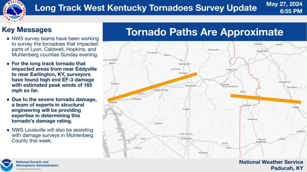
NWS in Paducah says the long tracked tornado from Eddyville to Earlington was at least a high end EF-3 with winds of 165mph. Structural engineering experts are being called in to assist in the damage rating.
A separate tornado was also confirmed in Muhlenberg County.

NWS in Paducah says the long tracked tornado from Eddyville to Earlington was at least a high end EF-3 with winds of 165mph. Structural engineering experts are being called in to assist in the damage rating. A separate tornado was also confirmed in Muhlenberg County. #kywx
account_circle
Chris Bailey🌪️🌩️(@Kentuckyweather) 's Twitter Profile Photo

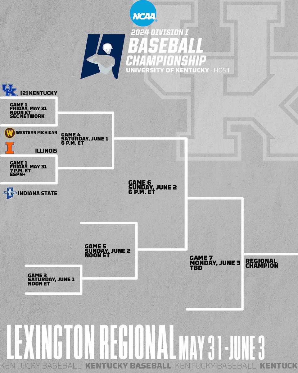
The weather for the Lexington Regional looks awesome to start on Friday with sun and 70-75 for highs. We will be on guard for a storm or two showing up Saturday, Sunday and Monday.

The weather for the Lexington Regional looks awesome to start on Friday with sun and 70-75 for highs. We will be on guard for a storm or two showing up Saturday, Sunday and Monday. #kywx #BBN
account_circle
Trent Baker(@Trent_Baker_KY) 's Twitter Profile Photo

Chris Bailey🌪️🌩️ We live in Mercer County and it appears to be a tornado. We did not have a tornado warning or severe thunderstorm warning until it was over. This is not the first this has happened.

account_circle
Chris Bailey🌪️🌩️(@Kentuckyweather) 's Twitter Profile Photo

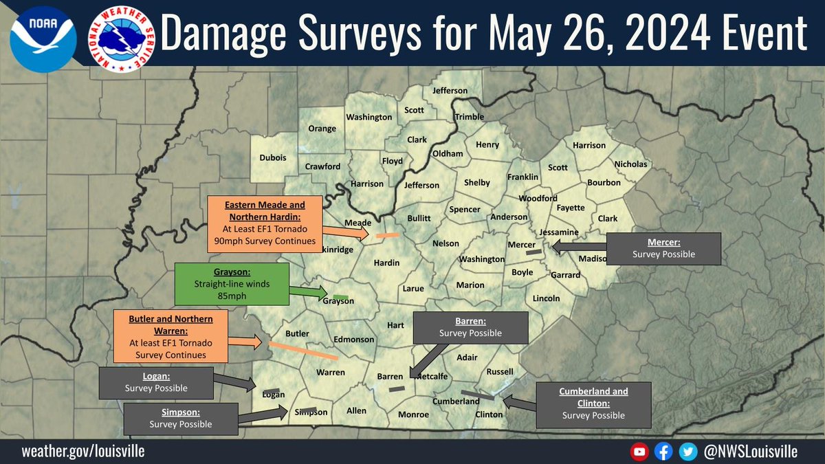
The NWS in Louisville has confirmed two tornadoes so far. EF-1 tornado touched down near the Meade/Hardin County line. Another EF-1 touched moved through Butler and Warren Counties. Additional surveys are underway.

The NWS in Louisville has confirmed two tornadoes so far. EF-1 tornado touched down near the Meade/Hardin County line. Another EF-1 touched moved through Butler and Warren Counties. Additional surveys are underway. #kywx
account_circle
Highly Caffeinated Sassypants(@ellisakoby) 's Twitter Profile Photo

Chris Bailey🌪️🌩️ Mostly tree damage in Green County. This was a 200+ yr old hickory that got blown over by winds coming up the hill. City of Greensburg road crew cleared it within two hours and were incredibly helpful in clearing other debris along the road.
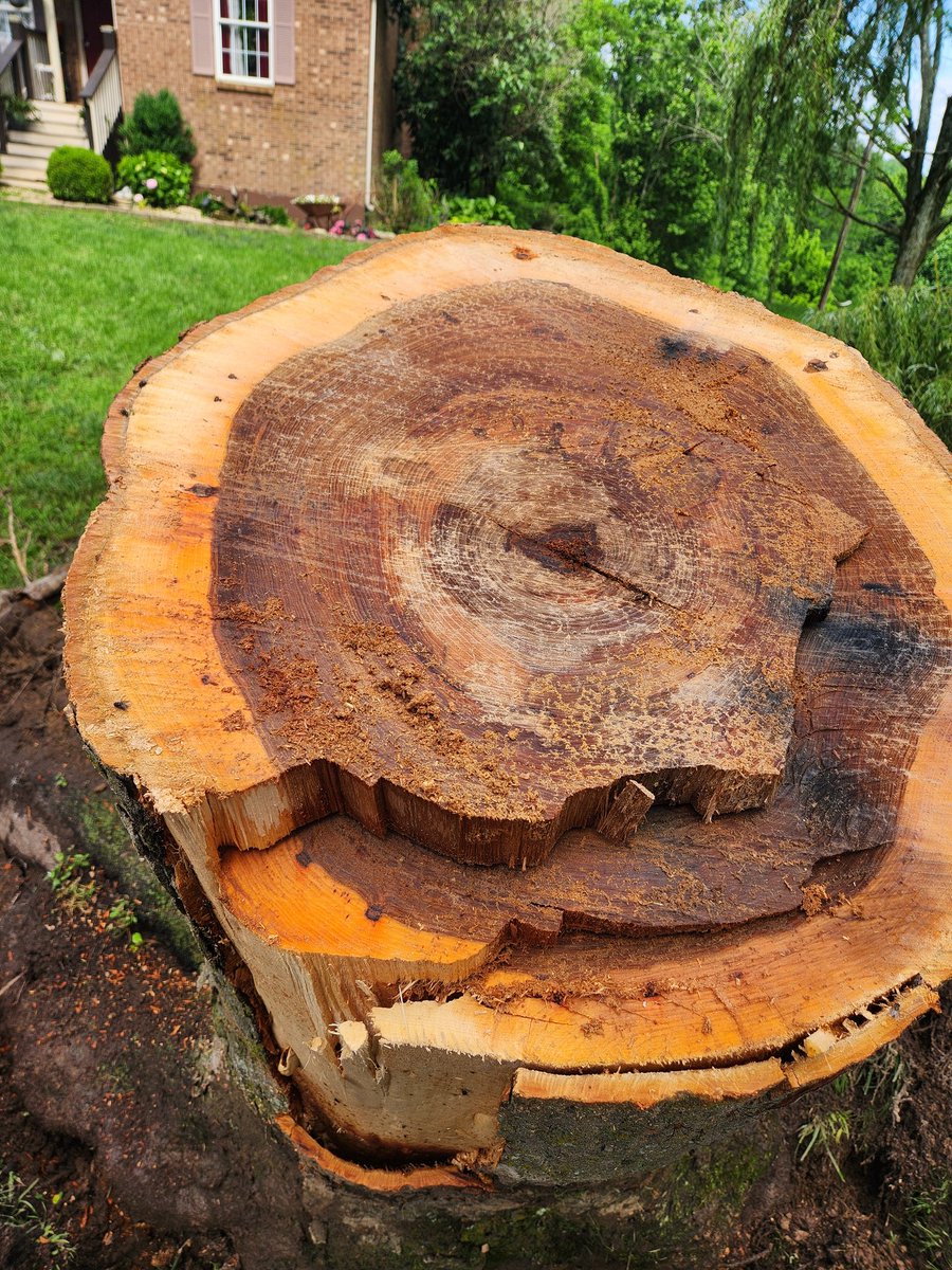
@Kentuckyweather Mostly tree damage in Green County. This was a 200+ yr old hickory that got blown over by winds coming up the hill. @GBurgKY road crew cleared it within two hours and were incredibly helpful in clearing other debris along the road.
account_circle
Chris Bailey🌪️🌩️(@Kentuckyweather) 's Twitter Profile Photo

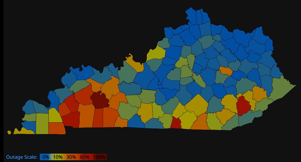
More than 165 thousand customers across Kentucky are still without power from our recent severe weather outbreak. Many of these customers have been without juice for more than 24 hours now.

More than 165 thousand customers across Kentucky are still without power from our recent severe weather outbreak. Many of these customers have been without juice for more than 24 hours now. #kywx
account_circle