Jamon Van Den Hoek(@JamonVDH) 's Twitter Profileg
Jamon Van Den Hoek

@JamonVDH

Conflict Ecology • Monitoring armed conflict, refugee landscapes, and long-term enviro change from space • Assoc Prof of Geography at Oregon State

ID:14564868

linkhttps://conflict-ecology.org calendar_today28-04-2008 03:14:55

1,8K Tweets

2,2K Followers

1,3K Following

Jamon Van Den Hoek(@JamonVDH) 's Twitter Profile Photo

Between 4 May 03:44:32 UTC and 8 May 15:49:05 UTC, we mapped 895 buildings in Rafah that were likely damaged or destroyed. This brings the total number of likely damaged/destroyed buildings in Rafah to 17,689 of 48,678 (36.3%). corey scher
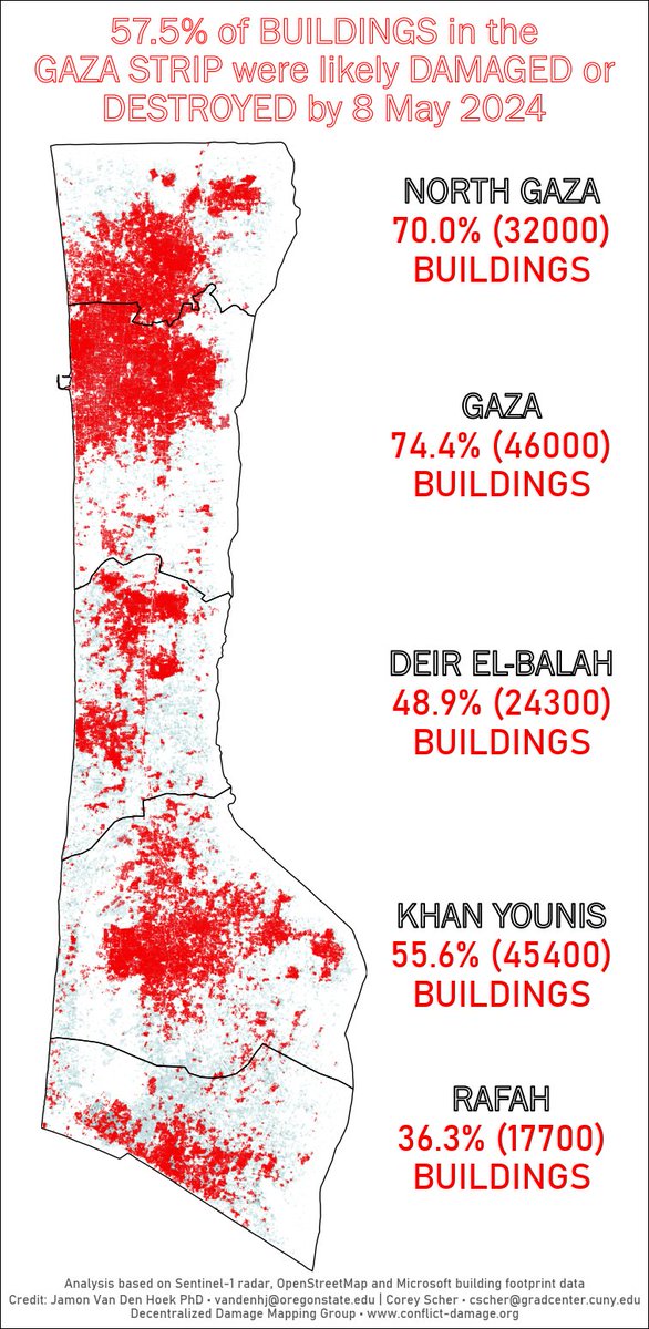

Between 4 May 03:44:32 UTC and 8 May 15:49:05 UTC, we mapped 895 buildings in Rafah that were likely damaged or destroyed. This brings the total number of likely damaged/destroyed buildings in Rafah to 17,689 of 48,678 (36.3%). @coreymaps
account_circle
NASAARSET 🛰🌎(@NASAARSET) 's Twitter Profile Photo

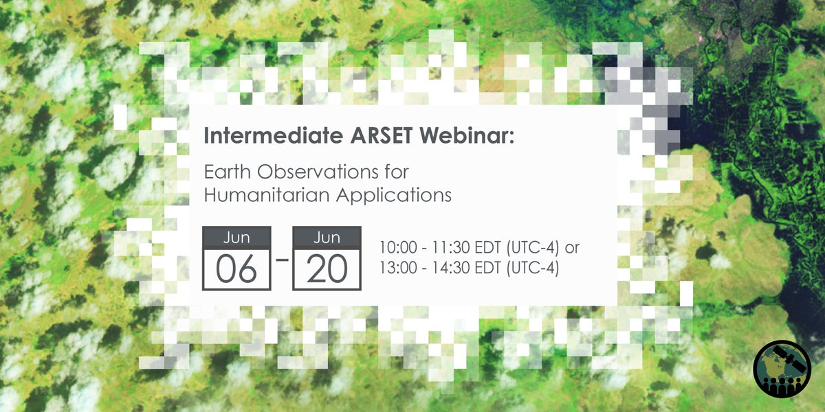
This training series will present strategies for using Earth observations to map and assess flood risk, drought affects on agriculture, and heat stress in refugee and IDP (Internally Displaced People) settings around the world.

Registration now open: go.nasa.gov/3wfv6g9

This training series will present strategies for using Earth observations to map and assess flood risk, drought affects on agriculture, and heat stress in refugee and IDP (Internally Displaced People) settings around the world. Registration now open: go.nasa.gov/3wfv6g9
account_circle
Beirut Urban Lab(@BeirutUrbanLab) 's Twitter Profile Photo

The scale of damage and impact of bombardment on the built environment of Gaza through our new 3D visualization➡️experience.arcgis.com/experience/5c2…

More on Tracking the Urbicide in Gaza ➡️ beiruturbanlab.com/en/Details/197…

account_circle
Eliot Higgins(@EliotHiggins) 's Twitter Profile Photo

A short preview of our upcoming documentary with Scripps News, that closely examines the ongoing violence in Gaza, both on the ground and with open source analysis:
youtube.com/watch?v=tNYnxH…

account_circle
jason kao(@cow_portal) 's Twitter Profile Photo

1/3 of Rafah’s buildings have been damaged or destroyed, according to the satellite analysis by corey scher and Jamon Van Den Hoek

Krishna Karra detected tents and new structures using Planet imagery. The data is public: github.com/BloombergGraph…

mapping by me and Jeremy C.F. Lin 林辰峰

1/3 of Rafah’s buildings have been damaged or destroyed, according to the satellite analysis by @coreymaps and @JamonVDH @k3blu3 detected tents and new structures using @planet imagery. The data is public: github.com/BloombergGraph… mapping by me and @Jeremy_CF_Lin
account_circle
Krishna Karra(@k3blu3) 's Twitter Profile Photo

we mapped tents in Rafah by applying machine learning to high resolution satellite imagery from Planet. we also show damaged buildings from analysis done by corey scher and Jamon Van Den Hoek. 🛰️

read here 🎁: bloomberg.com/graphics/2024-…

a small thread with some model specifics 🧵

account_circle
Land-Cover & Land-Use Change (LCLUC) Program(@LCLUCProgram) 's Twitter Profile Photo

Abena Boatemaa Asare-Ansah, UMD PhD student, presented at Land-Cover & Land-Use Change (LCLUC) Program meeting on behalf of PI Dr Van Den Hoek (Oregon St. U.). The project examines LCLUC effects of rapid, dynamic & regional population changes with the arrival of over 1M+ refugees to Uganda since 2015.More⬇️🔗
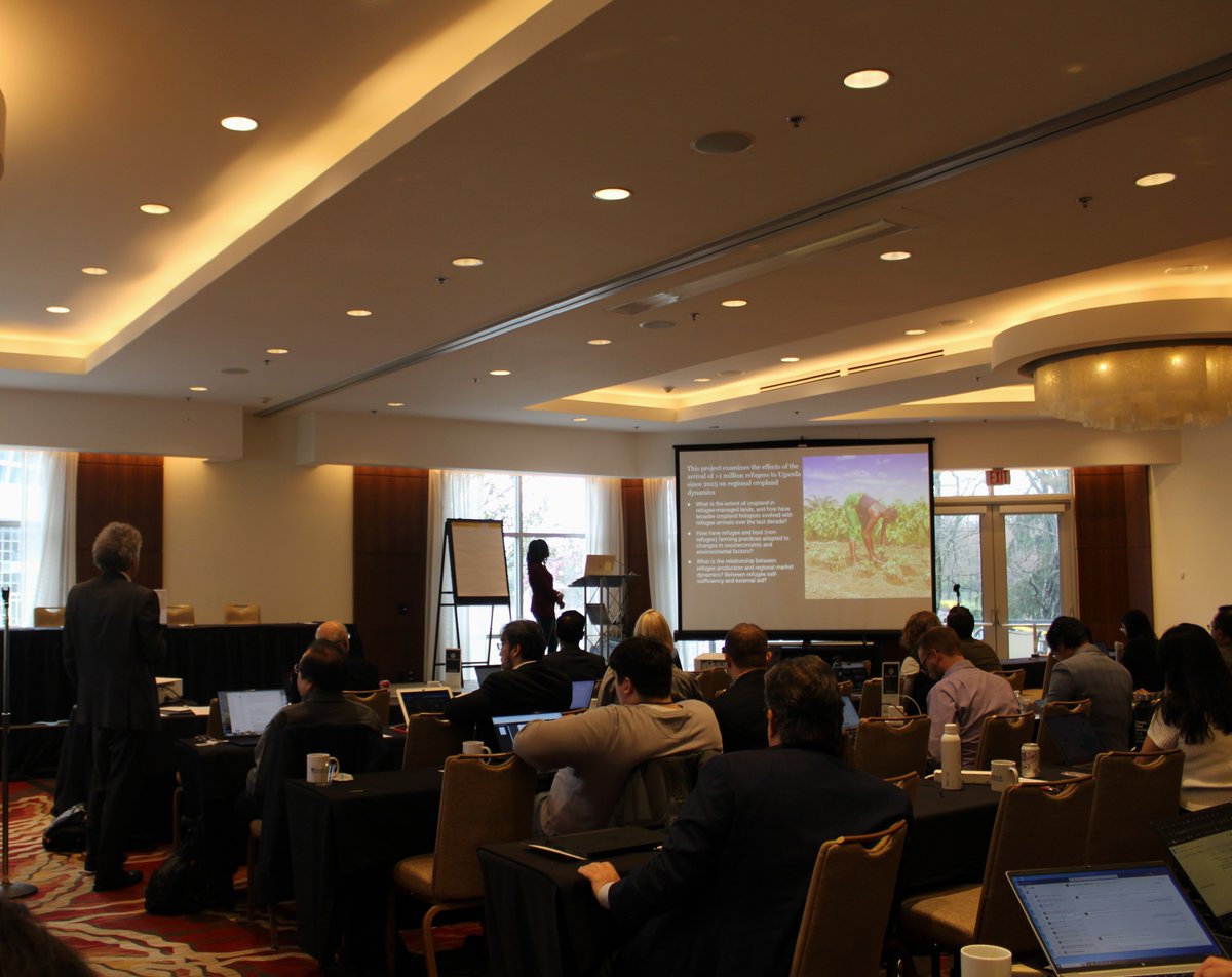
Abena Boatemaa Asare-Ansah, UMD PhD student, presented at @LCLUCProgram meeting on behalf of PI Dr Van Den Hoek (Oregon St. U.). The project examines LCLUC effects of rapid, dynamic & regional population changes with the arrival of over 1M+ refugees to Uganda since 2015.More⬇️🔗
account_circle
Land-Cover & Land-Use Change (LCLUC) Program(@LCLUCProgram) 's Twitter Profile Photo

This Friday join us to unlock the strategies for Multi-sensor Mapping of refugee agriculture in Uganda with Dr. Jamon Van Den Hoek Jamon Van Den Hoek and mitigating climate risks in the Arabian Peninsula with Dr. Cascade Cascade Tuholske Register Here: lp.constantcontactpages.com/ev/reg/4d7q3kt…
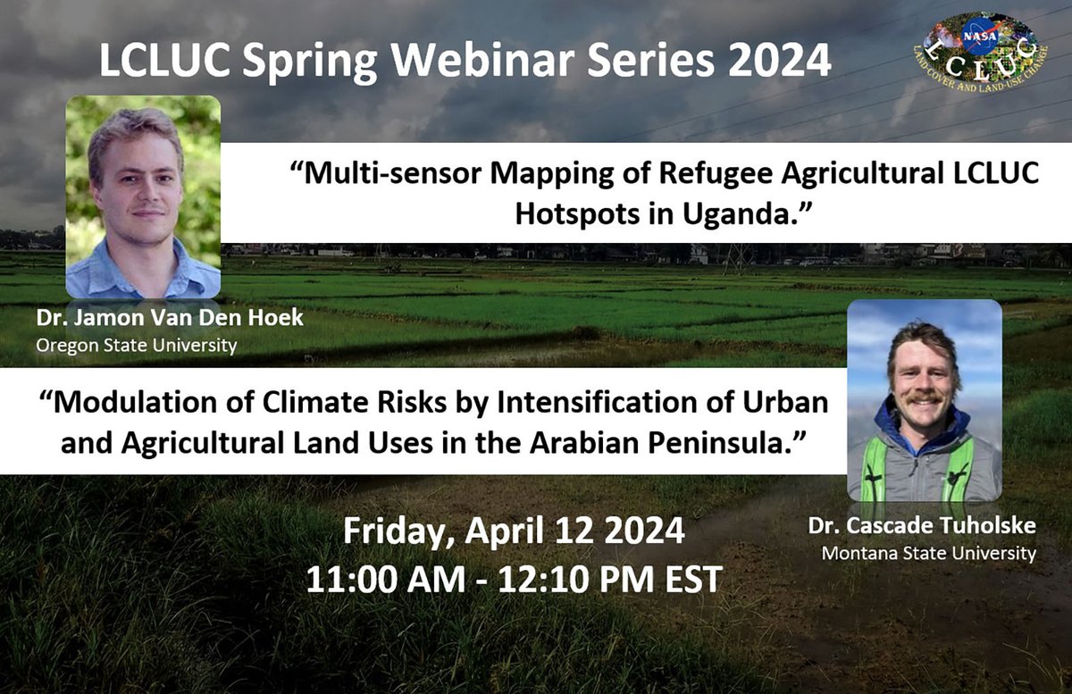
This Friday join us to unlock the strategies for Multi-sensor Mapping of refugee agriculture in Uganda with Dr. Jamon Van Den Hoek @JamonVDH and mitigating climate risks in the Arabian Peninsula with Dr. Cascade @Tuholske Register Here: lp.constantcontactpages.com/ev/reg/4d7q3kt…
account_circle
Yara Asi, PhD(@Yara_M_Asi) 's Twitter Profile Photo

🧵New paper in Conflict and Health: We used satellite imagery to detect damage to critical civilian infrastructure in from 7 Oct through 22 Nov. We find widespread, clustered damage around these sites, which are afforded special protections under IHL:

conflictandhealth.biomedcentral.com/articles/10.11…

account_circle
Lara Jirmanus, MD, MPH(@larazjmd) 's Twitter Profile Photo

New study findings suggest that has been intentionally decimating healthcare, schools & other civilian targets in .
This level of destruction was clear by November & has only gotten worse...
🙏🏽Yara Asi, PhD Jamon Van Den Hoek corey scher @sawsanAUB Nadine Bahour A. Kayum Ahmed

account_circle
MSU Earth Sciences Student Colloquium(@escicolloquium) 's Twitter Profile Photo

The 18th Annual Earth Sciences Student Colloquium at Montana State University (Montana State University) is just over a month away (Wednesday, April 24) and we are very excited to be hosting Dr. Jamon Van Den Hoek (@JamonVDH) as our keynote speaker.
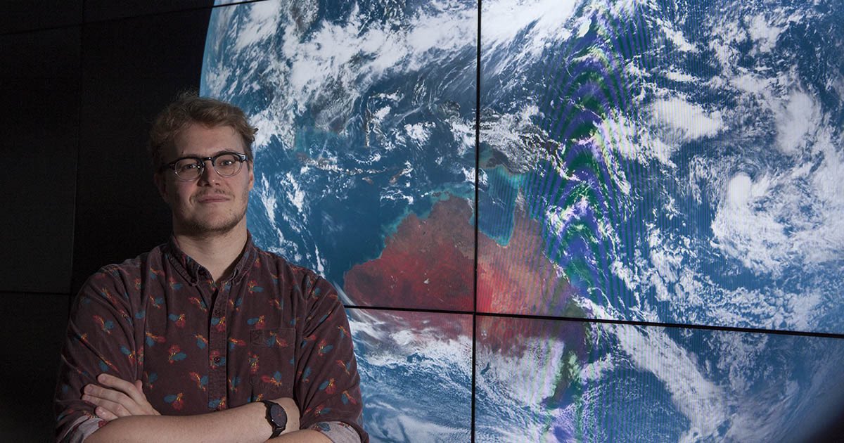
The 18th Annual Earth Sciences Student Colloquium at Montana State University (@montanastate) is just over a month away (Wednesday, April 24) and we are very excited to be hosting Dr. Jamon Van Den Hoek (@JamonVDH) as our keynote speaker.
account_circle
Global Investigative Journalism Network(@gijn) 's Twitter Profile Photo

💫NEW! As part of GIJN's series on the intersection of investigative journalism & – data journalist Hanna Duggal spoke with Jamon Van Den Hoek & corey scher, US-based researchers who are using satellite radar to document changes in Gaza's landscape.

Full Q&A: gijn.org/stories/using-…

account_circle
Alexander Prishchepov(@prial78) 's Twitter Profile Photo

A session on Extralegal land uses: Impacts of armed conflicts and illicit land uses on landscapes (122R) 5th GLP OSM: Nov 4-8, 2024 , Mexico! Submit your abstract DL: March 20! Dr. Lina Eklund Alexander Prishchepov Nick Magliocca He YIN | 殷贺 upcoming SI in JLUS bit.ly/3TI1JMu

A session on Extralegal land uses: Impacts of armed conflicts and illicit land uses on landscapes (122R) 5th @GlobalLandP OSM: Nov 4-8, 2024 #Oaxaca, Mexico! Submit your abstract DL: March 20! @eklund_lina @prial78 @nickmags13 @hyinhe upcoming SI in JLUS bit.ly/3TI1JMu
account_circle
Alexander Prishchepov(@prial78) 's Twitter Profile Photo

NOTE! Session '104R of rural and urban landscapes. Understanding the gradient and implications '. 5th GLP OSM: Nov 4-8, 2024 , Mexico! Submit your abstract Deadline: March 20! He YIN | 殷贺 Alexander Prishchepov Simona R. Gradinaru Alexander Vorbrugg event.fourwaves.com/osm2024/pages/…
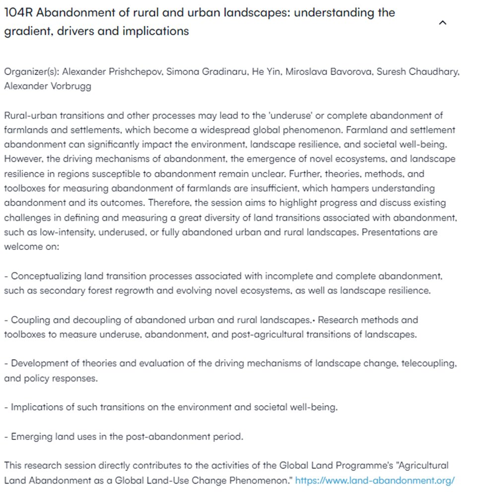
NOTE! Session '104R #Abandonment of rural and urban landscapes. Understanding the gradient and implications '. 5th @GlobalLandP OSM: Nov 4-8, 2024 #Oaxaca, Mexico! Submit your abstract Deadline: March 20! @hyinhe @prial78 @SR_Gradinaru @AVorbrugg event.fourwaves.com/osm2024/pages/…
account_circle
Vlad Sokolov(@whatislove_rv) 's Twitter Profile Photo

Developed and tested remote mine destruction algorithm (successful) ☑️

What does it give us?
- process automation
- no loss of time to work with wires for detonation
- no risk of premature detonation of the explosive charge

Most importantly, no need for the sapper to work

account_circle
Forensic Architecture(@ForensicArchi) 's Twitter Profile Photo

NEW INVESTIGATION: Since 7 Oct 23, the Israeli army has weaponised humanitarian measures such as ‘evacuation orders’, ‘safe routes’ & ‘safe zones’ to support their military operations & facilitate the mass displacement of Palestinians.

View the platform: gaza.forensic-architecture.org/displacement

account_circle
Jamon Van Den Hoek(@JamonVDH) 's Twitter Profile Photo

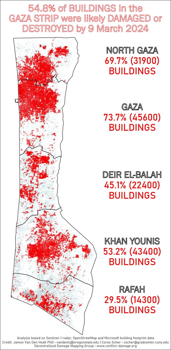
This is our 21st assessment of across . We don't see much new damage in this map but it's all relative. Hundreds of buildings being damaged in prior wars in Gaza would be notable. But it's only a 'rounding error' in this war of such extensive destruction. corey scher

This is our 21st assessment of #damage across #Gaza. We don't see much new damage in this map but it's all relative. Hundreds of buildings being damaged in prior wars in Gaza would be notable. But it's only a 'rounding error' in this war of such extensive destruction. @coreymaps
account_circle
Kevin Nguyen(@cog_ink) 's Twitter Profile Photo

For months, Jumana has documented her struggle to flee Gaza. Aussies have raised more than $70k to evacuate her family, but a locked-down border and a looming ground invasion is making this impossible. A special report from ABC Investigations and DSI:
abc.net.au/news/2024-03-0…

account_circle
Jamon Van Den Hoek(@JamonVDH) 's Twitter Profile Photo

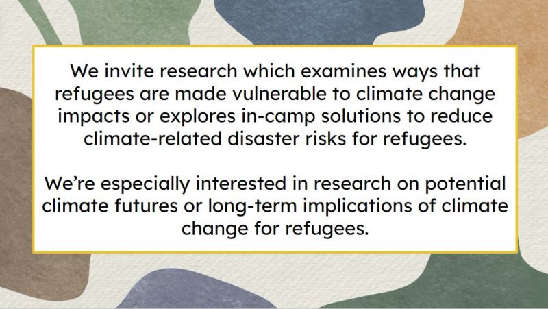
🚨Submissions are open for our special issue: *Addressing Climate Risks in Settings* in Frontiers in Climate. Manuscripts are due on 16 June 2024 just before World Refugee Day👉frontiersin.org/research-topic…

🚨Submissions are open for our special issue: *Addressing Climate Risks in #Refugee Settings* in Frontiers in Climate. Manuscripts are due on 16 June 2024 just before World Refugee Day👉frontiersin.org/research-topic…
account_circle