Copernicus EMS(@CopernicusEMS) 's Twitter Profileg
Copernicus EMS

@CopernicusEMS

Copernicus Emergency Management Service provides mapping products based on satellite imagery as well as #ForestFires #Flood and #Drought early warning products.

ID:2201283403

linkhttps://emergency.copernicus.eu/ calendar_today18-11-2013 13:05:56

39,0K Tweets

70,2K Followers

1,5K Following

Follow People
Copernicus EMS(@CopernicusEMS) 's Twitter Profile Photo

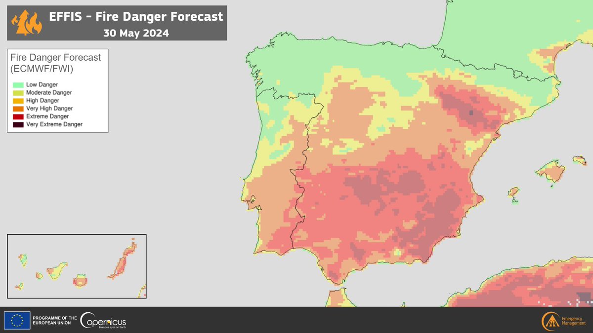
Today's Fire Danger Forecast shows varying levels of danger in most of the Iberian Peninsula

🔴'Extreme Danger' levels are present in areas of the , , , & regions of 🇪🇸

More at👇
forest-fire.emergency.copernicus.eu/apps/effis_cur…

Today's #EFFIS Fire Danger Forecast shows varying levels of danger in most of the Iberian Peninsula 🔴'Extreme Danger' levels are present in areas of the #Andalucía, #Murcia, #Aragòn, & #CastillaLaMancha regions of #Spain 🇪🇸 More at👇 forest-fire.emergency.copernicus.eu/apps/effis_cur…
account_circle
🇪🇺 DG DEFIS #StrongerTogether(@defis_eu) 's Twitter Profile Photo

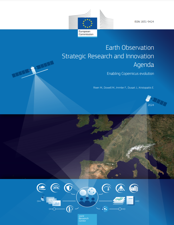
In the rapidly evolving space sector, R&I is key

The first ever SRIA (Strategic & Agenda on Observation), co-produced with EU_ScienceHub & EUScience&Innovation🇪🇺, has gathered input and requirements to enable the

In the rapidly evolving space sector, R&I is key The first ever SRIA (Strategic #Research & #Innovation Agenda on #Earth Observation), co-produced with @EU_ScienceHub & @EUScienceInnov, has gathered input and requirements to enable the #CopernicusEvolution
account_circle
Copernicus EMS(@CopernicusEMS) 's Twitter Profile Photo

that our On-Demand Mapping component provides key information to support emergency response and recovery efforts for ? 🔥

Read more 👇
…tection-humanitarian-aid.ec.europa.eu/news-stories/n…

#DYK that our On-Demand Mapping component provides key information to support emergency response and recovery efforts for #wildfires? 🔥 Read more 👇 …tection-humanitarian-aid.ec.europa.eu/news-stories/n…
account_circle
UNDRR(@UNDRR) 's Twitter Profile Photo

What is the impact of human presence on flooding?

Changes in hydrological processes & extreme events are connected with human actions altering river basins globally.

This report explores related impact of urbanisation trends 👉ow.ly/Qa7e50S0FNF

account_circle
EU Humanitarian Aid | Latin America & Caribbean(@ECHO_LatAm) 's Twitter Profile Photo

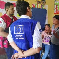
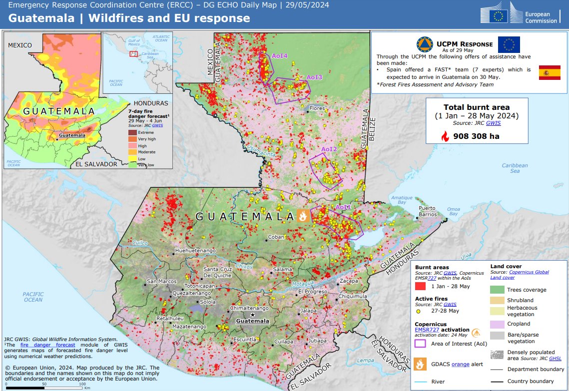
In response to wildfires in Guatemala, the EU activated Copernicus EU for rapid mapping and is deploying seven experts from Spain via the Mechanism to help local authorities.

We stand ready to help further.

acortar.link/ZPaXFx

In response to wildfires in Guatemala, the EU activated @CopernicusEU for rapid mapping and is deploying seven experts from Spain via the #EUCivilProtection Mechanism to help local authorities. We stand ready to help further. acortar.link/ZPaXFx
account_circle
Copernicus EMS(@CopernicusEMS) 's Twitter Profile Photo

🔥 in 🇬🇹

Our has been tasked to monitor 6 new Areas of Interest

➡️Sierra del Lacandón
➡️La Union Barrios
➡️Rio Hondo
➡️Jacaltenango
➡️Volcán Tajumulco
➡️Santa Maria de Jesús

More updates are coming soon!

🔗rapidmapping.emergency.copernicus.eu/EMSR727/report…
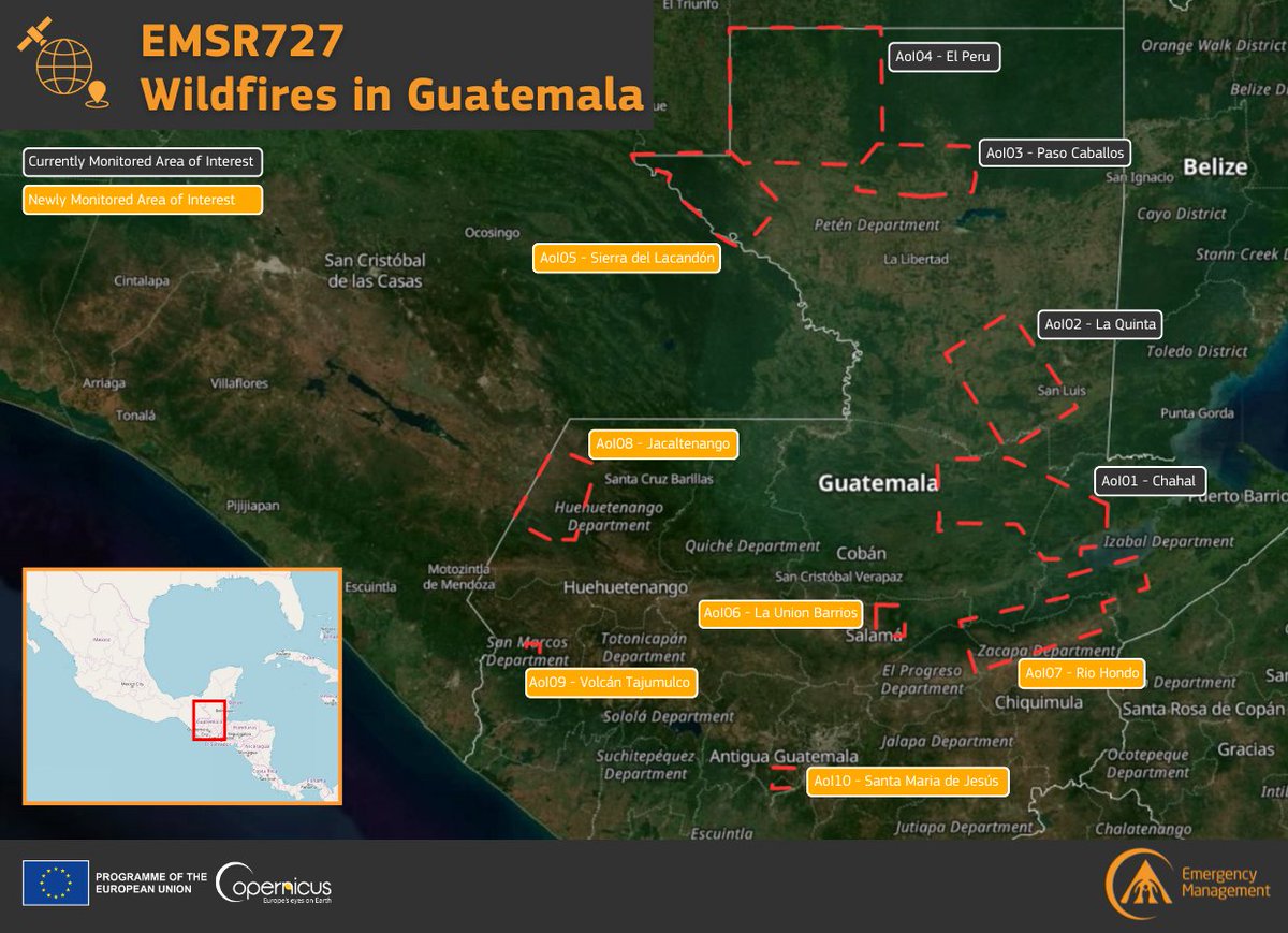
#EMSR727 #Wildfires 🔥 in #Guatemala 🇬🇹 Our #MappingTeam has been tasked to monitor 6 new Areas of Interest ➡️Sierra del Lacandón ➡️La Union Barrios ➡️Rio Hondo ➡️Jacaltenango ➡️Volcán Tajumulco ➡️Santa Maria de Jesús More updates are coming soon! 🔗rapidmapping.emergency.copernicus.eu/EMSR727/report…
account_circle
Copernicus EMS(@CopernicusEMS) 's Twitter Profile Photo

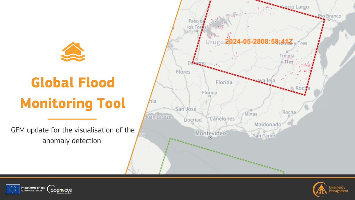
Our Global Flood Monitoring tool 🌊 has recently been updated with a 🆕 visualisation scheme for anomaly detection 🗺️

Users are now able to see which of the latest 🇪🇺🛰️ image tiles contain a significant amount of

📎global-flood.emergency.copernicus.eu/news/169-minor…

Our Global Flood Monitoring #GFM tool 🌊 has recently been updated with a 🆕 visualisation scheme for anomaly detection 🗺️ Users are now able to see which of the latest #Copernicus #Sentinel1 🇪🇺🛰️ image tiles contain a significant amount of #flooding 📎global-flood.emergency.copernicus.eu/news/169-minor…
account_circle
EU Environment(@EU_ENV) 's Twitter Profile Photo

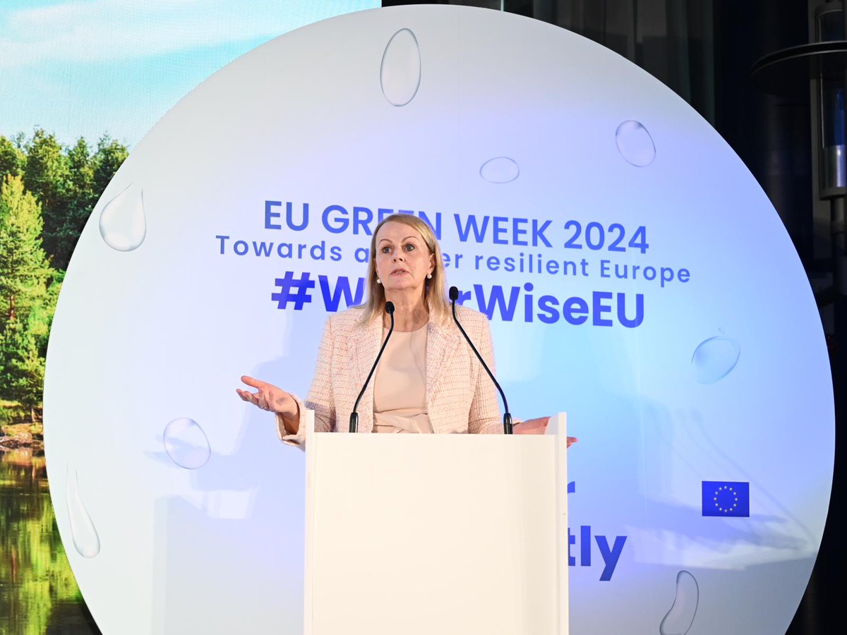
Welcome to the 2024 from 🇪🇺 Director General Florika Fink-Hooijer🇪🇺, a week of exciting events to see water differently!

Across the EU, water issues are worsening due to , mismanagement, pollution & ecosystems degradation.

We need change, we need a

Welcome to the #EUGreenWeek 2024 from 🇪🇺 Director General @florikafink, a week of exciting events to see water differently! Across the EU, water issues are worsening due to #ClimateChange, mismanagement, pollution & ecosystems degradation. We need change, we need a #WaterWiseEU
account_circle
Copernicus EMS(@CopernicusEMS) 's Twitter Profile Photo

in 🇧🇿

So far, over 17,000 hectares of burnt areas have been detected 🔥

Our continues to monitor the situation and will provide additional products in the coming days

Read more in our Situational Reporting at👇
rapidmapping.emergency.copernicus.eu/EMSR726/report…

account_circle
Copernicus EMS(@CopernicusEMS) 's Twitter Profile Photo

🔥 in 🇬🇹

Our has been tasked to monitor 6 new Areas of Interest

➡️Sierra del Lacandón
➡️La Union Barrios
➡️Rio Hondo
➡️Jacaltenango
➡️Volcán Tajumulco
➡️Santa Maria de Jesús

More updates are coming soon!

🔗rapidmapping.emergency.copernicus.eu/EMSR727/report…

#EMSR727 #Wildfires 🔥 in #Guatemala 🇬🇹 Our #MappingTeam has been tasked to monitor 6 new Areas of Interest ➡️Sierra del Lacandón ➡️La Union Barrios ➡️Rio Hondo ➡️Jacaltenango ➡️Volcán Tajumulco ➡️Santa Maria de Jesús More updates are coming soon! 🔗rapidmapping.emergency.copernicus.eu/EMSR727/report…
account_circle
Copernicus EMS(@CopernicusEMS) 's Twitter Profile Photo

Our Global Flood Monitoring tool 🌊 has recently been updated with a 🆕 visualisation scheme for anomaly detection 🗺️

Users are now able to see which of the latest 🇪🇺🛰️ image tiles contain a significant amount of

📎global-flood.emergency.copernicus.eu/news/169-minor…

Our Global Flood Monitoring #GFM tool 🌊 has recently been updated with a 🆕 visualisation scheme for anomaly detection 🗺️ Users are now able to see which of the latest #Copernicus #Sentinel1 🇪🇺🛰️ image tiles contain a significant amount of #flooding 📎global-flood.emergency.copernicus.eu/news/169-minor…

account_circle
UNDRR(@UNDRR) 's Twitter Profile Photo

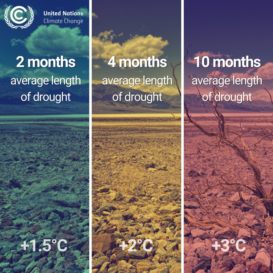
Every fraction of a degree matters!
To reach we must:
1️⃣stop the creation of new risks by rapidly reducing emissions
2️⃣ accelerate action on climate change adaptation and disaster risk reduction
ow.ly/gIq450RYHKP

Every fraction of a degree matters! To reach #ZeroClimateDisasters we must: 1️⃣stop the creation of new risks by rapidly reducing emissions 2️⃣ accelerate action on climate change adaptation and disaster risk reduction ow.ly/gIq450RYHKP #COP28
account_circle
Unión Europea en Guatemala(@UEGuatemala) 's Twitter Profile Photo

en 🇬🇹

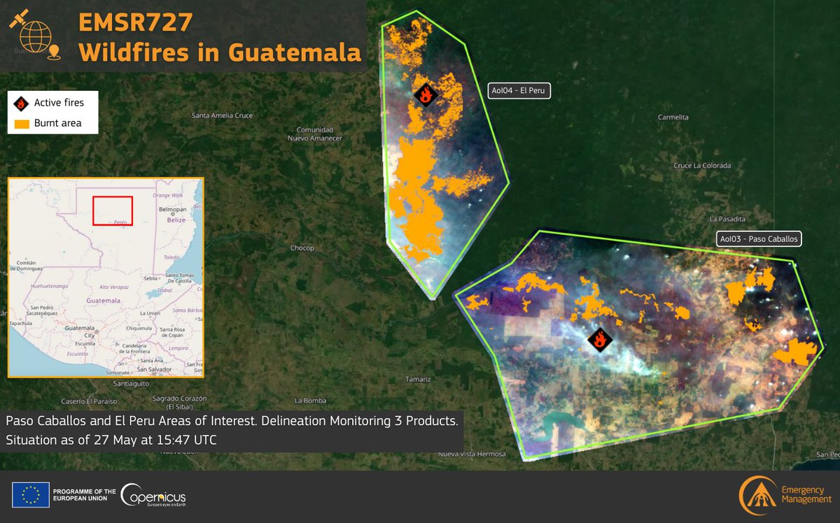
Copernicus EMS entregó el 3er Producto de Monitoreo de Delineación para las Áreas de Interés Paso Caballos y El Perú

A partir del 27 de mayo
➡️ Un total de +21,200 ha se han quemado a través de las 2 AoIs.
rapidmapping.emergency.copernicus.eu/EMSR727/report…

#EMSR727 #IncendiosForestales en #Guatemala 🇬🇹 @CopernicusEMS entregó el 3er Producto de Monitoreo de Delineación para las Áreas de Interés Paso Caballos y El Perú A partir del 27 de mayo ➡️ Un total de +21,200 ha se han quemado a través de las 2 AoIs. rapidmapping.emergency.copernicus.eu/EMSR727/report…
account_circle
🇧🇿 Belize GEO 🛰️(@BzGEO) 's Twitter Profile Photo

In addition to the Mountain Pine Ridge Forest Reserve (damage in yellow), the Vaca Forest Reserve (damage in red, next to the western border) has also been impacted by the recent 🔥 in 🇧🇿. 😬

account_circle
EU Humanitarian Aid | Latin America & Caribbean(@ECHO_LatAm) 's Twitter Profile Photo

Wildfires rage across Central America, threatening health, livelihoods, and the environment.

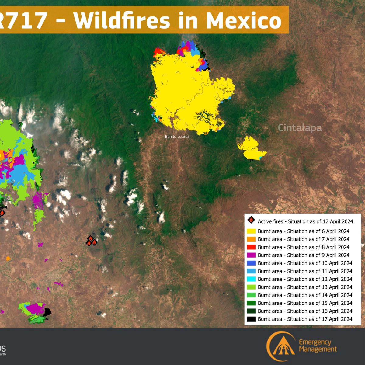
Copernicus EMS, part of the EU Space Programme, aids with rapid mapping for damage assessment in Guatemala (EMSR727), Belize (EMSR726), and Mexico (EMSR717).

acortar.link/9q4N0o

Wildfires rage across Central America, threatening health, livelihoods, and the environment. @CopernicusEMS, part of the EU Space Programme, aids with rapid mapping for damage assessment in Guatemala (EMSR727), Belize (EMSR726), and Mexico (EMSR717). acortar.link/9q4N0o
account_circle
Copernicus EMS(@CopernicusEMS) 's Twitter Profile Photo

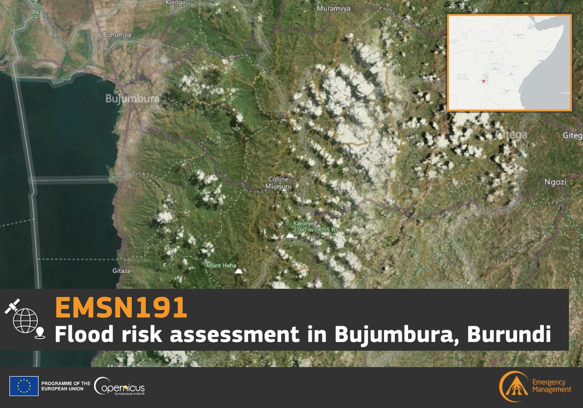
🇧🇮

Following the success of , our has been tasked with modelling several 🌊 scenarios for Lake Tanganyika and their potential impact on critical infrastructure

Read more at 👇
…skandrecovery.emergency.copernicus.eu/EMSN191/

#EMSN191 #Burundi 🇧🇮 Following the success of #EMSN190, our #MappingTeam has been tasked with modelling several #flooding 🌊 scenarios for Lake Tanganyika and their potential impact on critical infrastructure Read more at 👇 …skandrecovery.emergency.copernicus.eu/EMSN191/
account_circle
Copernicus EMS(@CopernicusEMS) 's Twitter Profile Photo

in 🇬🇹

Our delivered the 3rd Delineation Monitoring Product for the Paso Caballos and El Peru Areas of Interest

As of 27 May, at 15:47 UTC
➡️A total of +21,200 ha have burnt across the 2 AoIs

More details at👇
rapidmapping.emergency.copernicus.eu/EMSR727/report…
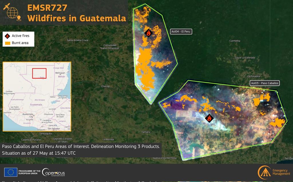
#EMSR727 #Wildfires in #Guatemala 🇬🇹 Our #MappingTeam delivered the 3rd Delineation Monitoring Product for the Paso Caballos and El Peru Areas of Interest As of 27 May, at 15:47 UTC ➡️A total of +21,200 ha have burnt across the 2 AoIs More details at👇 rapidmapping.emergency.copernicus.eu/EMSR727/report…
account_circle