Dan Pope(@weathercaster) 's Twitter Profileg
Dan Pope

@weathercaster

Certified Broadcast and Consulting TV Meteorologist at Fox13 in SLC, Utah. I report on Meteorology, Astronomy, Geology & Science in general, plus I fly drones.

ID:14392427

linkhttps://www.instagram.com/dan_pope_meteorologist/ calendar_today15-04-2008 01:16:41

44,2K Tweets

2,1K Followers

767 Following

NWS Storm Prediction Center(@NWSSPC) 's Twitter Profile Photo

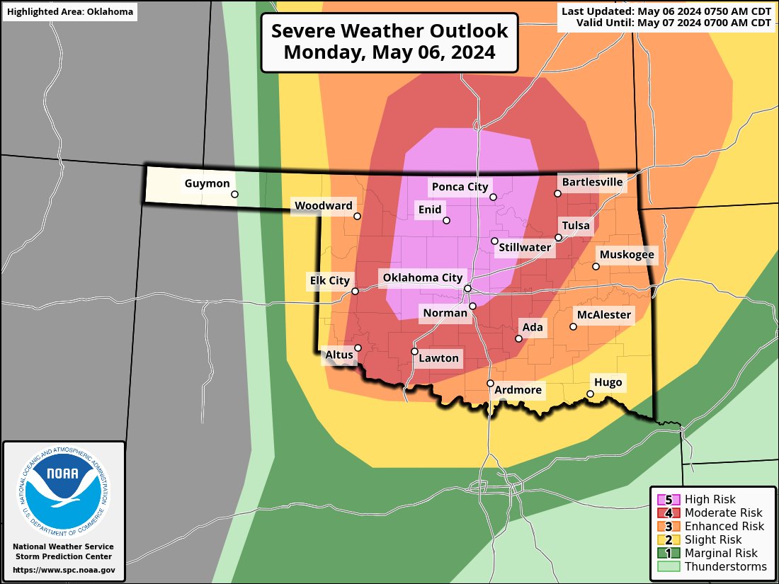
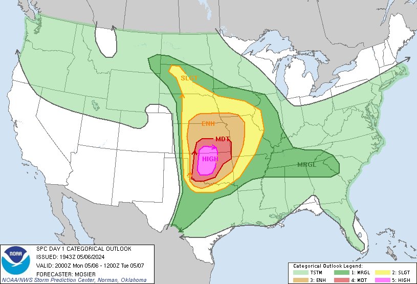
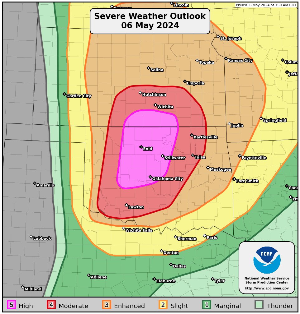
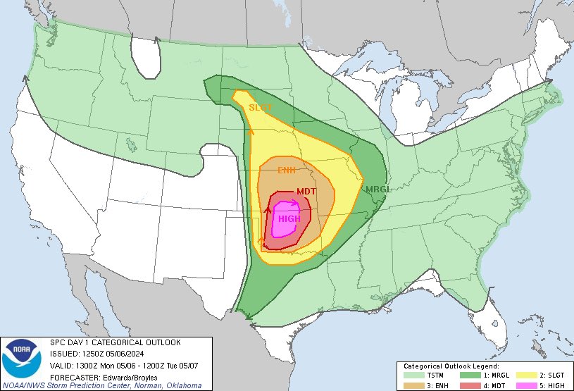
2:45pm CDT Day1 Outlook High Risk: from central and northern Oklahoma into south-central Kansas spc.noaa.gov/products/outlo…

2:45pm CDT #SPC Day1 Outlook High Risk: from central and northern Oklahoma into south-central Kansas spc.noaa.gov/products/outlo…
account_circle
Snowbird(@Snowbird) 's Twitter Profile Photo

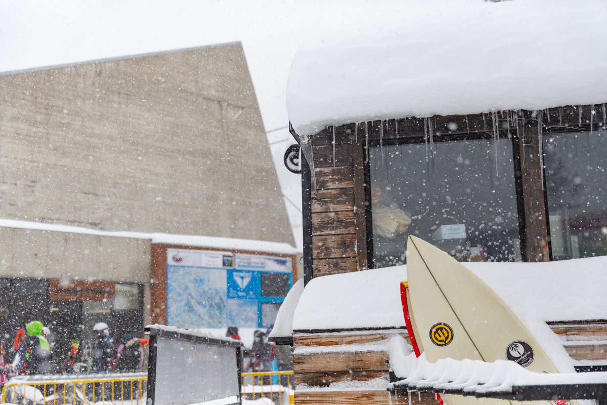
One of the biggest storms of the season is here, bringing with it a lot of everything: SO much snow, wind, stoke, hard work from our teams & patience from our guests. As we look to break the 600” mark for season-to-date snowfall overnight, it feels more like February than May🤘

One of the biggest storms of the season is here, bringing with it a lot of everything: SO much snow, wind, stoke, hard work from our teams & patience from our guests. As we look to break the 600” mark for season-to-date snowfall overnight, it feels more like February than May🤘
account_circle
Brighton Resort(@BrightonResort) 's Twitter Profile Photo

14 INCHES OVERNIGHT 🥹❄️ This is the middle of our boardercross right now. These spring conditions are not what we were expecting, but we aren’t complaining 🌨️

account_circle
Gabe Garfield(@WxGabe) 's Twitter Profile Photo

Some thoughts on today's High Risk:

1. The atmosphere will be uncapped by 1 pm. So, storms could fire early.

2. If they fire early, shear will be limited. But strong low-level CAPE/stretching could result in tornadoes regardless.

3. Rich moisture will linger closer to I-35. So…

Some thoughts on today's High Risk: 1. The atmosphere will be uncapped by 1 pm. So, storms could fire early. 2. If they fire early, shear will be limited. But strong low-level CAPE/stretching could result in tornadoes regardless. 3. Rich moisture will linger closer to I-35. So…
account_circle
Brad Arnold(@BradArnoldWX) 's Twitter Profile Photo

I have a sick feeling that today is going to be a day that folks in this area are going to talk about for many many years. SPC has pulled the trigger on the very rare high risk. I’m begging everyone if you live in the threat area, please take today seriously and have multiple…

I have a sick feeling that today is going to be a day that folks in this area are going to talk about for many many years. SPC has pulled the trigger on the very rare high risk. I’m begging everyone if you live in the threat area, please take today seriously and have multiple…
account_circle
Thomas Silas(@tpsilas18) 's Twitter Profile Photo

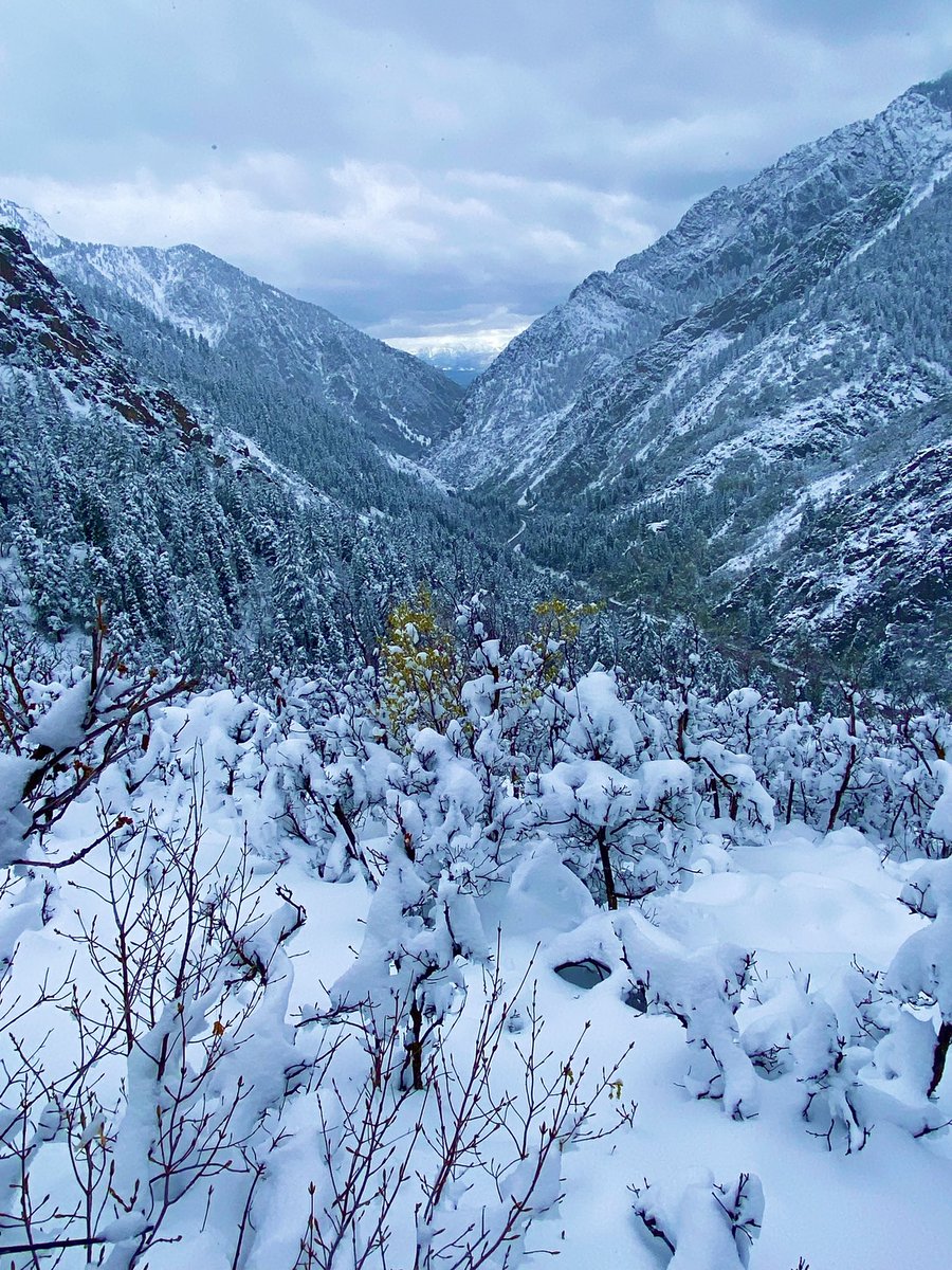
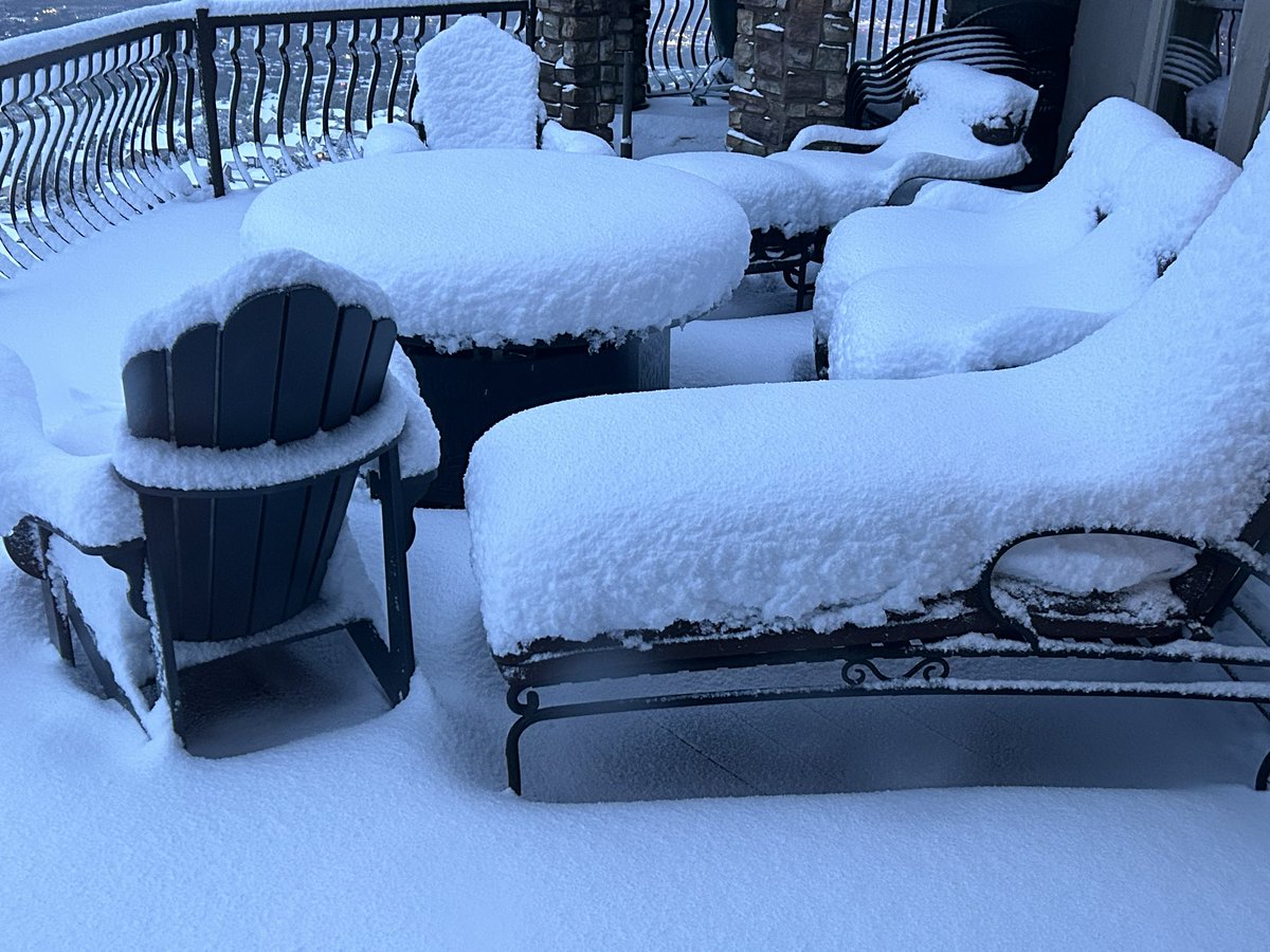
8.7 inches on the ground this morning. Has to be the biggest snow depth I’ve ever seen here in May. South Bountiful bench 5400 ft. NWS Salt Lake City Chase Thomason

8.7 inches on the ground this morning. Has to be the biggest snow depth I’ve ever seen here in May. South Bountiful bench 5400 ft. #utwx @NWSSaltLakeCity @ChaseThomason
account_circle
Matthew Cappucci(@MatthewCappucci) 's Twitter Profile Photo

BREAKING: A level 5 out of 5 HIGH RISK of tornadoes has been drawn across Oklahoma and Kansas.

This is the most severe risk category the NWS Storm Prediction Center can deliver.

Strong to violent long-track tornadoes are expected. Giant hail to grapefruit size is too.

SHARE safety tips here:
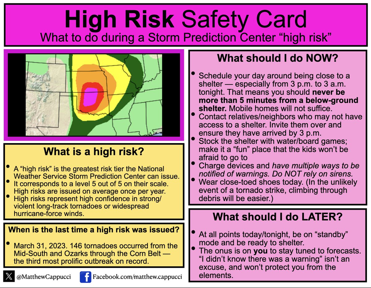
BREAKING: A level 5 out of 5 HIGH RISK of tornadoes has been drawn across Oklahoma and Kansas. This is the most severe risk category the @NWSSPC can deliver. Strong to violent long-track tornadoes are expected. Giant hail to grapefruit size is too. SHARE safety tips here:
account_circle
Devin(@taylordevin1) 's Twitter Profile Photo

NWS Salt Lake City my buddy just sent me this in upper bountiful. Elevation prob around 5700 feet. He hasn’t measure but thinks it’s over 15 inches.

@NWSSaltLakeCity my buddy just sent me this in upper bountiful. Elevation prob around 5700 feet. He hasn’t measure but thinks it’s over 15 inches.
account_circle
R A W S A L E R T S(@rawsalerts) 's Twitter Profile Photo

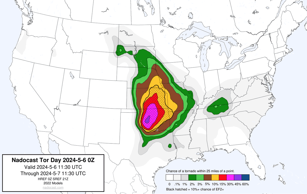
🚨 : An Extremely dangerous and life threatening tornado outbreak will likely take place today in parts of Oklahoma into Kansas

📌 |

The Storm Prediction Center has issued an extremely rare historic high-risk alert for numerous large,…

account_circle
Dan Pope(@weathercaster) 's Twitter Profile Photo

Incoming severe thunderstorms, with tornadoes, large hail, and microburst winds coming today. Know where your safe place is and monitor local radio and social media for incoming extreme weather.

account_circle