Sorah Suhng(@SorahSuhng) 's Twitter Profile Photo

COVER DROP!

Cos & Effect exclusive for ! You can get it via the presale online tinyurl.com/3aadck7e OR you can pick it up from @ Booth 1332!

Lines by me, colors by the always amazing Ceci de la Cruz 🎨🖌️

COVER DROP!

Cos & Effect exclusive for #C2E2! You can get it via the presale online tinyurl.com/3aadck7e OR you can pick it up from @ Booth 1332! 

Lines by me, colors by the always amazing @cecidlcruz #makeart #makecomics #cosandeffect #windycity
account_circle
WindyCity Weather and News(@WindyCityWxMan) 's Twitter Profile Photo

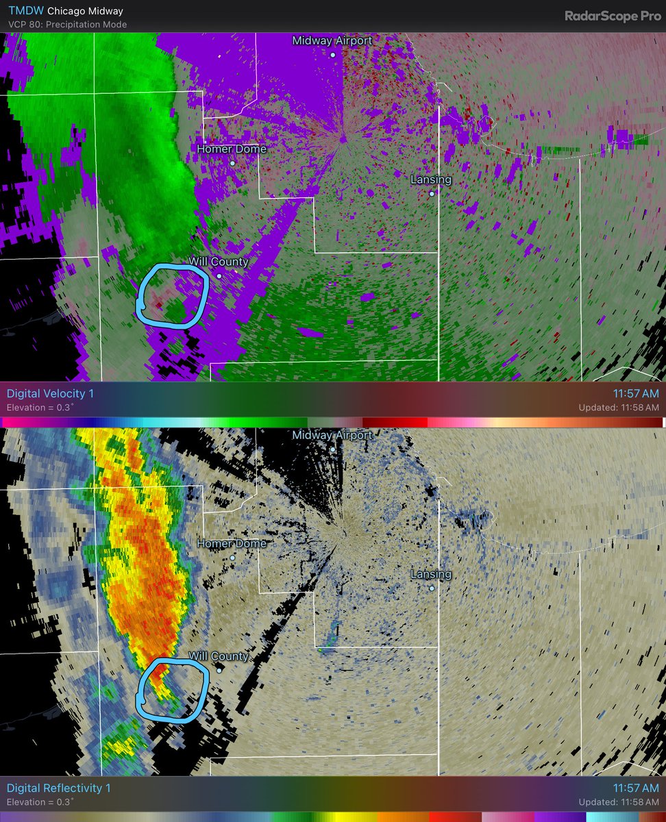
A line of storms is indeed forming out west and a single cell north of DeKalb might be producing some nickel size hail

These sweep mostly the northern metro thru early Monday rush hour

Biggest hazard is marginally severe hail, wind gusts, low chance but poss tornado

account_circle
WindyCity Weather and News(@WindyCityWxMan) 's Twitter Profile Photo


Northern Cook County even though no current warnings, line directly to your west continues to build

Lots of lightning in these storms, small hail possible, wind gusts in strongest parts

Threat thru 8PM

account_circle
WindyCity Weather and News(@WindyCityWxMan) 's Twitter Profile Photo

Ever hear the air rushing out of a storm balloon?

I’m by no means official but I’m thinking stick a fork in this one

account_circle
Nick Hoffmann(@n194at) 's Twitter Profile Photo

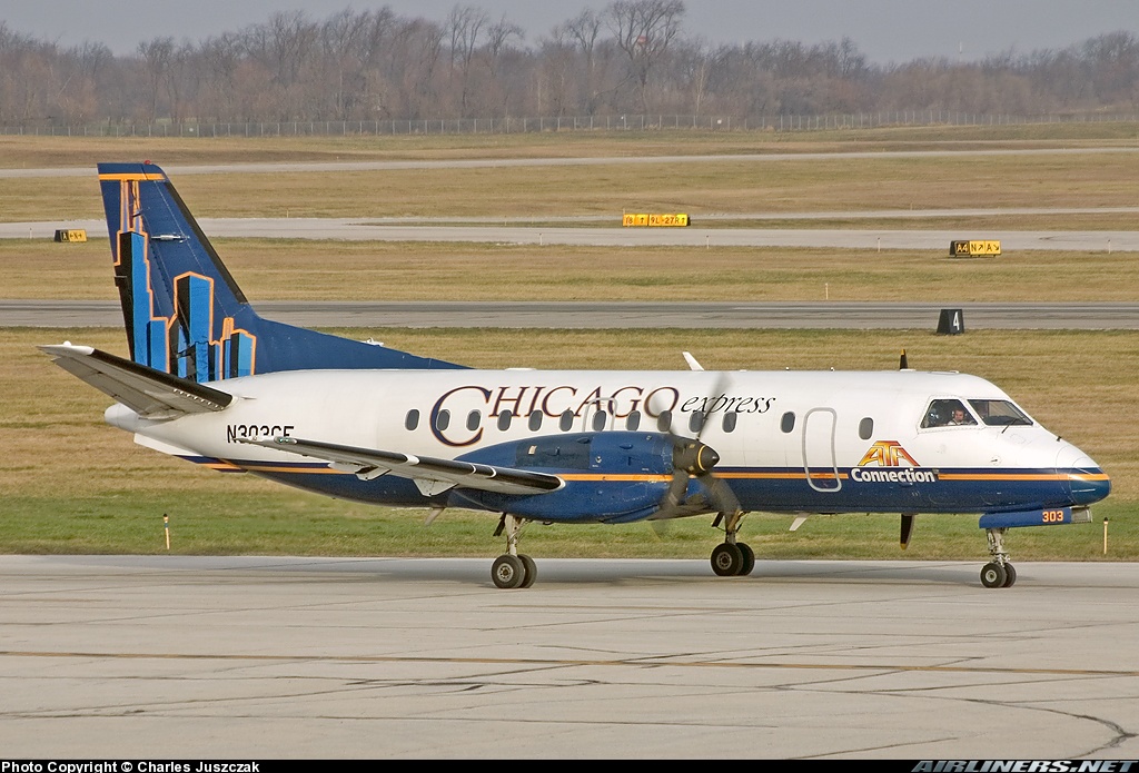
Chicago Express - ATA Connection
Saab 340B N303CE
SBN/KSBN South Bend International Airport
December 4, 2004
Photo credit Charles Juszczak
Jumpseated on her MDW-MKE July 16, 2001
s

Chicago Express - ATA Connection
Saab 340B N303CE 
SBN/KSBN South Bend International Airport
December 4, 2004
Photo credit Charles Juszczak
Jumpseated on her MDW-MKE July 16, 2001
#AvGeek #Saab #WindyCity #SBN #WDY #ATA #AvGeeks #SouthBend #ChicagoExpress
account_circle
WindyCity Weather and News(@WindyCityWxMan) 's Twitter Profile Photo


Folks along the Illinois/Wisconsin state line pay attention to this cluster which will track the border thru 6:30PM

Still watching to see if that south tail of the cluster can build down and clip some of the metro area

account_circle
WindyCity Weather and News(@WindyCityWxMan) 's Twitter Profile Photo

Always watch the tail end inflow on a cluster like this as it start taking over its environment

Untapped and unstable air all around this. Just how fast and hard it sucks it in is worth watching

Always watch the tail end inflow on a cluster like this as it start taking over its environment 

Untapped and unstable air all around this. Just how fast and hard it sucks it in is worth watching
account_circle
Nick Hoffmann(@n194at) 's Twitter Profile Photo

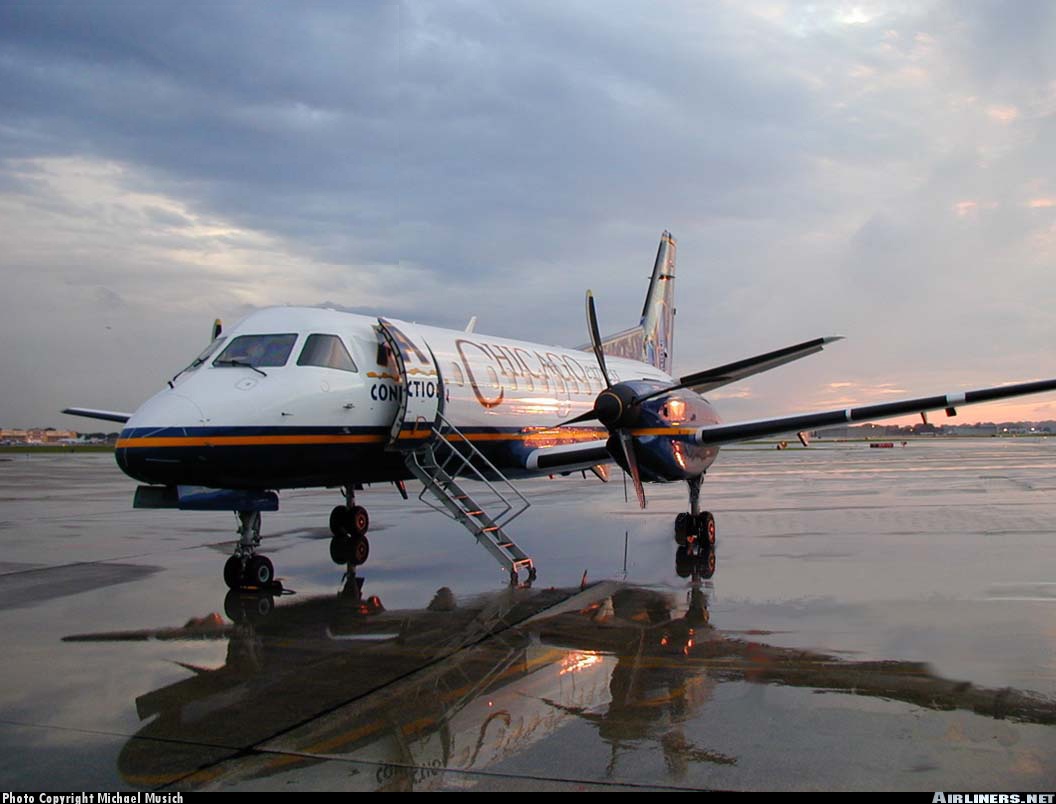
Chicago Express (ATA Connection)
Saab 340B N308CE
MDW/KMDW Chicago Midway International Airport
June 1, 2000
Photo credit Michael Musich
Jumpseated on her MDW-IND Nov 3, 2000
s Express Midway Intl. Airport

Chicago Express (ATA Connection)  
Saab 340B N308CE  
MDW/KMDW Chicago Midway International Airport 
June 1, 2000
Photo credit Michael Musich
Jumpseated on her MDW-IND Nov 3, 2000
#AvGeek #AvGeeks #Saab #WindyCity #ChicagoExpress #ATA #AmericanTransAir #MDW #Chicago @fly2midway
account_circle
WindyCity Weather and News(@WindyCityWxMan) 's Twitter Profile Photo

Part of the problem in this area is the lack of Doppler radar coverage

Much of NE Missouri is not close to either the Davenport radar nor the St Louis radar and the Central IL radar

We shall see how this looks as it moves into IL and catches more beams

account_circle
WindyCity Weather and News(@WindyCityWxMan) 's Twitter Profile Photo

weather

Northern Kane and northern Cook may see some storms get going as the southern end of that line showing some life

If you’re outdoors now across the northern metro the weather could change quickly

Keep an eye to the sky and to your favorite weather alert

account_circle
風都郊外(@windycity1415) 's Twitter Profile Photo

ウィア魂行くしなあと思ってWE ARE履修してるんだけど、やっぱ何回聴いてもまっすーのソロが無いのはイカれてる

account_circle
WindyCity Weather and News(@WindyCityWxMan) 's Twitter Profile Photo

Very well defined wind max pushing E/NE from east central Iowa

Areas from the MS River to I-39 corridor thru 10AM will get hit by this part of the line

As it races toward NE IL and best system dynamics will pull north toward Wis, will actual storm dynamics sustain it?

account_circle
WindyCity Weather and News(@WindyCityWxMan) 's Twitter Profile Photo

Messy weather Friday

Storm complex living well thru the night has crossed Nebraska and is trekking Iowa

Models thru the day push the line into IL with new development late afternoon

Severe risk looks best in the 5-8PM range in

Storms ahead of line also possible

account_circle