
NASA Landsat(@NASA_Landsat) 's Twitter Profile Photo

Canada’s largest national park, Wood Buffalo National Park, features unique wildlife and what is believed to be the world’s largest beaver dam. 🦫

NASA’s Terra satellite captured the boundaries of the park while 9 acquired an image of the dam.

go.nasa.gov/3VsrLEB

Canada’s largest national park, Wood Buffalo National Park, features unique wildlife and what is believed to be the world’s largest beaver dam. 🦫

NASA’s Terra satellite captured the boundaries of the park while #Landsat 9 acquired an image of the dam.

go.nasa.gov/3VsrLEB
account_circle
NASA Earth(@NASAEarth) 's Twitter Profile Photo

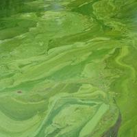
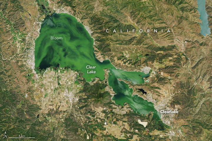
Clear Lake was anything but clear in May!

The lake in California is prone to algal blooms, like the green swirls seen in this image. But blooms have become more frequent in recent years due to increased nutrient inputs. go.nasa.gov/3R4usJI

Clear Lake was anything but clear in May!

The lake in California is prone to algal blooms, like the green swirls seen in this #Landsat image. But blooms have become more frequent in recent years due to increased nutrient inputs. go.nasa.gov/3R4usJI
account_circle
Maartje Korver(@maartjekorver) 's Twitter Profile Photo

The first chapter of my PhD research has been published!🥳We present LakeTEMP: a dataset of 8 surface water temperature observations and ice phenology estimations for all lakes in the world that are larger than 0.1 km² (~1.4 million).🧵 sciencedirect.com/science/articl…

account_circle
NASA Goddard(@NASAGoddard) 's Twitter Profile Photo

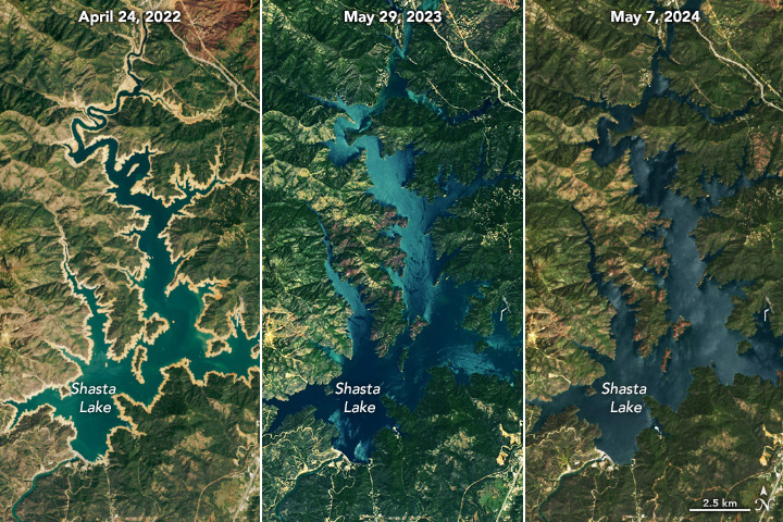
Free refills?

Two consecutive wet winters in Northern California provided enough water to fill up Shasta Lake for the second year in a row. The lake is California’s largest reservoir. imagery like these helps scientists surface water resources.
go.nasa.gov/3yzHGYF

Free refills?

Two consecutive wet winters in Northern California provided enough water to fill up Shasta Lake for the second year in a row. The lake is California’s largest reservoir. #Landsat imagery like these helps scientists surface water resources.
go.nasa.gov/3yzHGYF
account_circle
MT Anderson(@MT_Anderson) 's Twitter Profile Photo

🇺🇸CARRIER STRIKE GROUP 2🇺🇸
Spotted on Landsat 8-9 (27 May 2024) ~270km NW of 🇸🇦Al Qunfudhah. Along with USS Dwight D. Eisenhower (IKE) is Ticonderoga Class Cruiser USS Philippine Sea (CG-58)

Likely flight ops underway with two aircraft spotted SE of the carrier
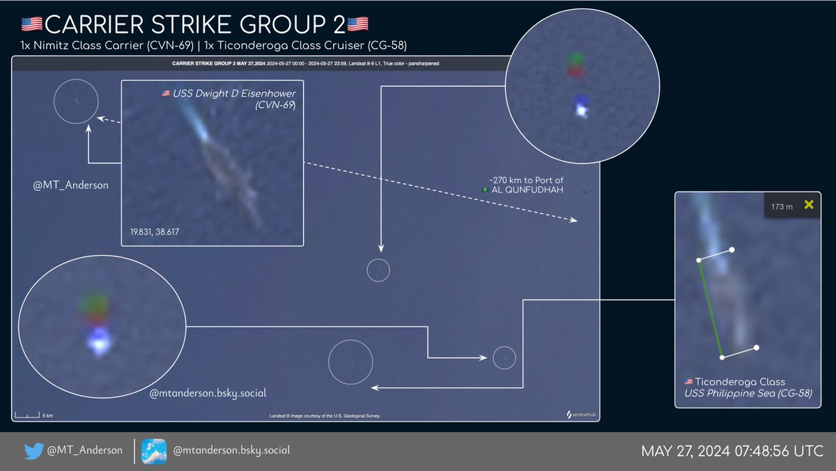
🇺🇸CARRIER STRIKE GROUP 2🇺🇸
Spotted on Landsat 8-9 (27 May 2024) ~270km NW of 🇸🇦Al Qunfudhah. Along with @TheCVN69 is Ticonderoga Class Cruiser USS Philippine Sea (CG-58)

Likely flight ops underway with two aircraft spotted SE of the carrier
account_circle
Dr Robbi Bishop-Taylor 🛰️🌎🌊(@SatelliteSci) 's Twitter Profile Photo

Satellite data from NASA Landsat is the ultimate tool for understanding how coastal processes shape and affect our coasts over time.🛰️🌊

This animation maps the rise & fall of the tide over Australia's Montgomery Reef using 37 years of satellite imagery

account_circle
Ricky D Phillips - Military Historian(@RDPHistory) 's Twitter Profile Photo

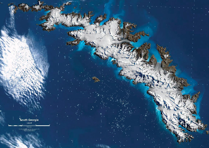
April 24th 1982: Argentina, a party to NASA's Landsat satellite programme, asks NASA for images over South Georgia. Citing 'Technical Problems' NASA declines, but can't keep up the pretence for long....

(continues)

April 24th 1982: Argentina, a party to NASA's Landsat satellite programme, asks NASA for images over South Georgia. Citing 'Technical Problems' NASA declines, but can't keep up the pretence for long....

(continues)
account_circle
Qiusheng Wu(@giswqs) 's Twitter Profile Photo

Visualization and Analysis of the Rio Grande do Sul (April 29-May 16, 2024) in Brazil with optical imagery and Sentinel-1 SAR data

Notebook: share.gishub.org/brazil_floods
Colab: colab.research.google.com/github/giswqs/…

account_circle
Ricky D Phillips - Military Historian(@RDPHistory) 's Twitter Profile Photo

May 7th 1982: Unable to fool the Argentines with stories of 'technical difficulties' any more, the USA starts giving Argentina satellite photographs under the LANDSAT programme, which give the junta a good idea of the location of British ships. The USA neglects to tell the UK 🙄

May 7th 1982: Unable to fool the Argentines with stories of 'technical difficulties' any more, the USA starts giving Argentina satellite photographs under the LANDSAT programme, which give the junta a good idea of the location of British ships. The USA neglects to tell the UK 🙄
account_circle
USGS HDDS(@USGS_HDDS) 's Twitter Profile Photo

2 scenes of LANDSAT ingested to HDDS for event 201911_Volcano_Sabancaya_PER hddsexplorer.usgs.gov/criteria?event…

2 scenes of LANDSAT ingested to HDDS for event 201911_Volcano_Sabancaya_PER #Sabancaya #volcano hddsexplorer.usgs.gov/criteria?event…
account_circle
Ricky D Phillips - Military Historian(@RDPHistory) 's Twitter Profile Photo

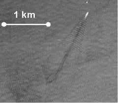
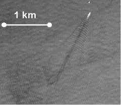
May 4th 1982: The UK plays down false rumours of American satellite intelligence, but notes that the American NOAA Landsat weather satellite is publishing pictures over the area. In fact, Argentina is tracking the fleet with it by following the wakes of the British ships.

May 4th 1982: The UK plays down false rumours of American satellite intelligence, but notes that the American NOAA Landsat weather satellite is publishing pictures over the area. In fact, Argentina is tracking the fleet with it by following the wakes of the British ships.
account_circle
Nuutti Kiljunen(@NuuttiKiljunen) 's Twitter Profile Photo

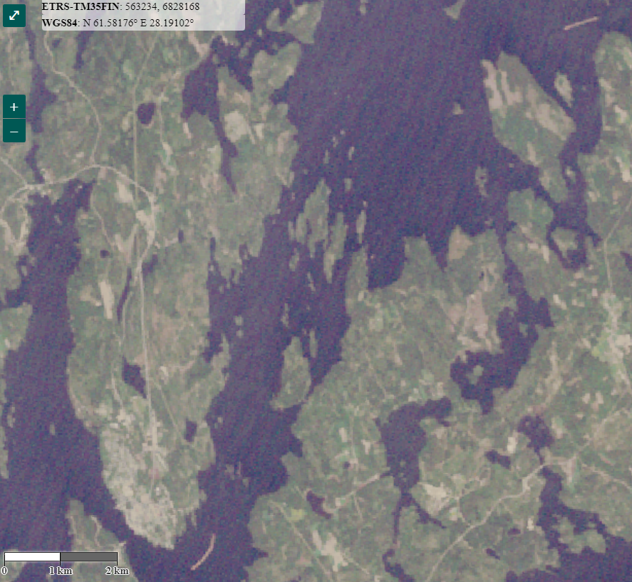
Landsat 4 tuli käyttöön 1982, 5 1984.
Syken Tarkka-palvelusta voi katsella noillakin otettuja vanhoja satelliittikuvia.
35 v. sitten 26.5.1989 uitto täydessä käynnissä.
Kuvan alareunassa lautta on pian Puumalan lossilla. Oikeassa yläkulmassa seuraava lautta Kietävälänvirralla.

Landsat 4 tuli käyttöön 1982, 5 1984. 
Syken Tarkka-palvelusta voi katsella noillakin otettuja vanhoja satelliittikuvia. 
35 v. sitten 26.5.1989 uitto täydessä käynnissä. 
Kuvan alareunassa lautta on pian Puumalan lossilla. Oikeassa yläkulmassa seuraava lautta Kietävälänvirralla.
account_circle
Una finestra des de l'espai(@UEspai) 's Twitter Profile Photo

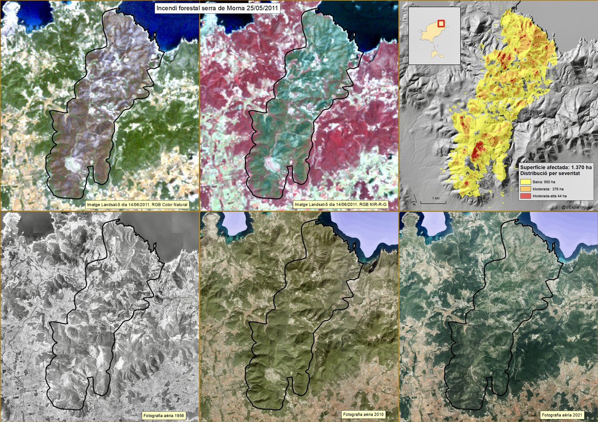
Una imatge del satèl·lit Landsat-5 de dia 14/06/2011 permet reconstruir la petjada de l'incendi, amb un mapa de severitat dibuixant una sèrie 'd'illes verdes' dins el perímetre.

Una imatge del satèl·lit Landsat-5 de dia 14/06/2011 permet reconstruir la petjada de l'incendi, amb un mapa de severitat dibuixant una sèrie 'd'illes verdes' dins el perímetre.
account_circle
₦₳V𝚜𝚝é𝚟𝚊 🇷🇺 ᴢ(@Navsteva) 's Twitter Profile Photo

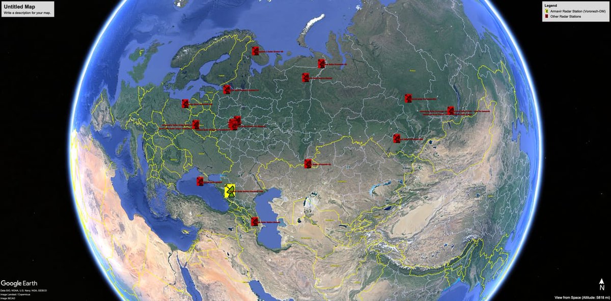
Location of Russian strategic defense radar installations, with Armavir highlighted in yellow. Credit: Google Earth, SIO, NOAA, U.S. Navy, NGA, GEBCO, Landsat / Copernicus, IBCAO

Location of Russian strategic defense radar installations, with Armavir highlighted in yellow. Credit: Google Earth, SIO, NOAA, U.S. Navy, NGA, GEBCO, Landsat / Copernicus, IBCAO
account_circle
Ricky D Phillips - Military Historian(@RDPHistory) 's Twitter Profile Photo

May 11th 1982: US State Department admits to the UK that Argentina has received satellite imagery from them since May 7th under the LANDSAT programme. The USA forwards the images to the UK to show what Argentina has. These are the only satellite images the UK receives in the war.

May 11th 1982: US State Department admits to the UK that Argentina has received satellite imagery from them since May 7th under the LANDSAT programme. The USA forwards the images to the UK to show what Argentina has. These are the only satellite images the UK receives in the war.
account_circle