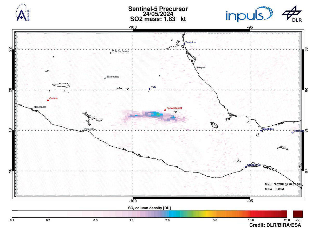
On 2024-05-24 #TROPOMI has detected an enhanced SO2 signal of 3.02DU at a distance of 39.6km to #Popocatepetl . #DLR_inpuls TROPOMI #S5p #Sentinel5p DLR - English BIRA-IASB ESA Earth Observation #SO2LH

Der #Vulkanausbruch auf #Galapagos im Blick von Sentinel-5P. 🌋👀 Das Messinstrument TROPOMI an Bord des Satelliten zeichnet u.a. die Schwefeldioxid-Konzentration in der Atmosphäre auf. 🛰️ Die Daten helfen, Beeinträchtigungen für den Flugverkehr einzuschätzen um warnen zu können.

When #wildfires burn, a lot more than #smoke is emitted. Here are observations from TROPOMI, showing strong distinct nitrogen dioxide plumes across #Sicily .
Sadly these events will only get more frequent.
Made with Sentinel Hub, NOAA Satellites, TROPOMI & Copernicus EU


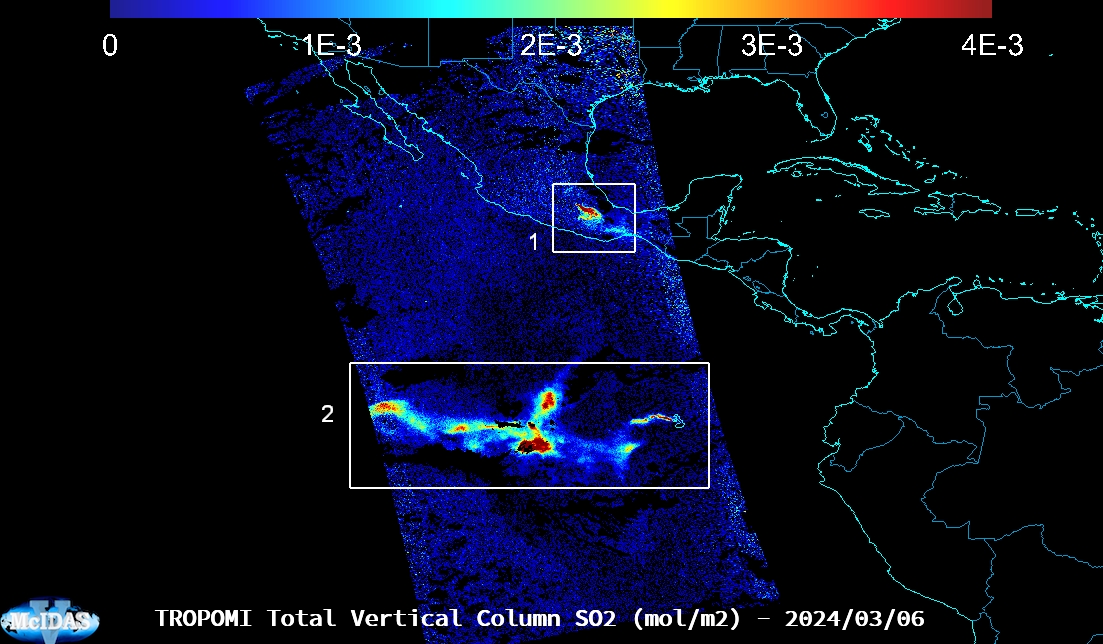
TROPOMI detecting volcanic SO2 plumes from #Popocatepetl in #Mexico and #LaCumbre in the #Galapagos Islands on 03/06/2024. Made with McIDAS-V.


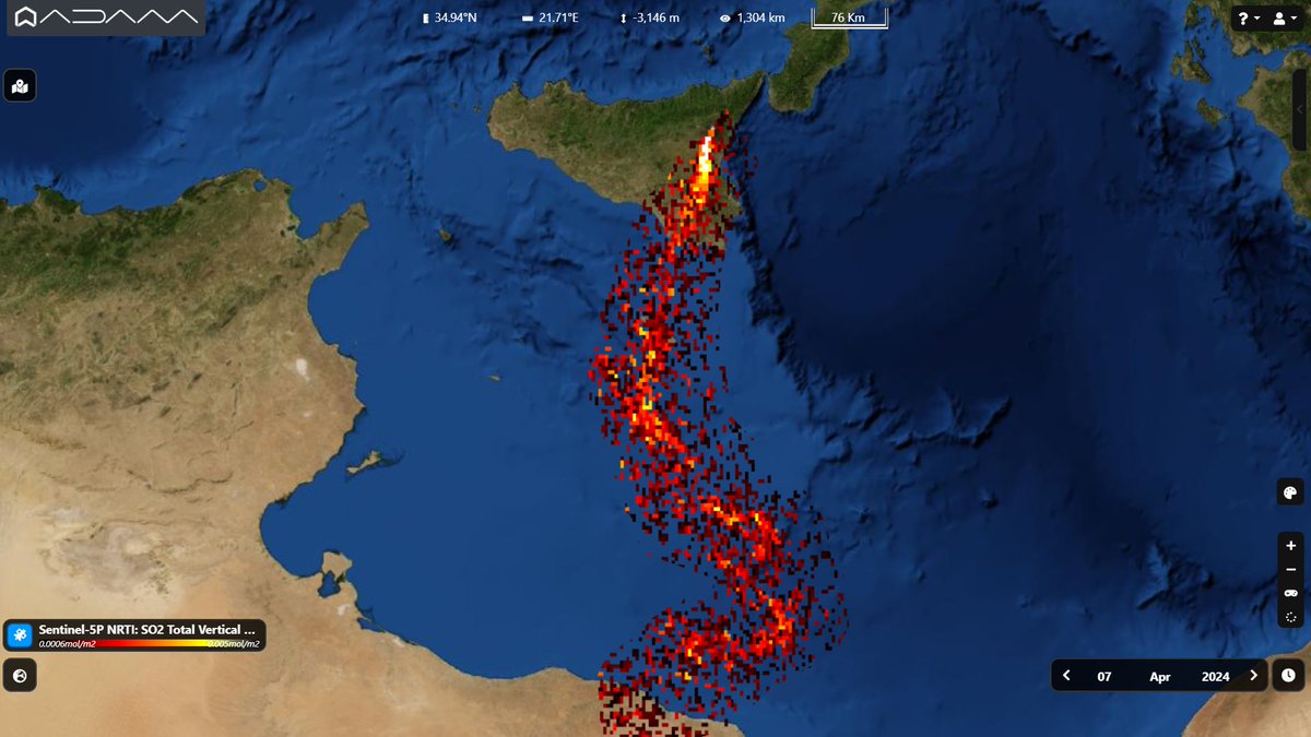
An SO2 plume from #Etna was already visible less than two hours before the explosion.
#Copernicus #Sentinel5p #tropomi detected the emission from the #volcano on April 7 at 13,51.
Il lungo plume di anidride solforosa dall'Etna visto da satellite prima dell'eruzione di domenica.


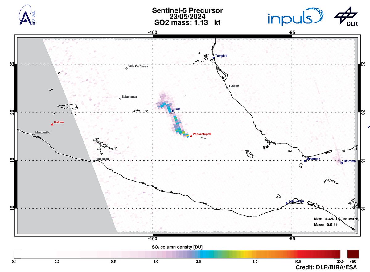
On 2024-05-23 #TROPOMI has detected an enhanced SO2 signal of 4.32DU at a distance of 13.7km to #Popocatepetl . #DLR_inpuls TROPOMI #S5p #Sentinel5p DLR - English BIRA-IASB ESA Earth Observation #SO2LH


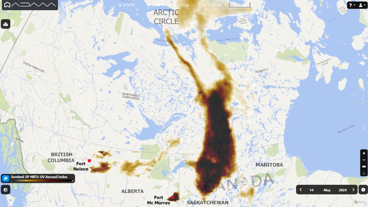
Smoke from several #BritishColumbia and #Alberta #fires reached #arcticcircle . As shown by the #Copernicus #Sentinel5p #Tropomi map on May 14 the plume from intense fires in #Canada is moving Northward.
#BCwildfire #ABwildfire
EUMETSAT Giulio Betti David Wallace-Wells Prof. Katharine Hayhoe

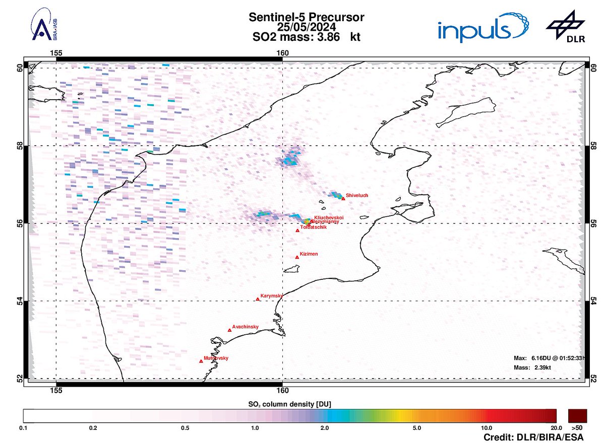
On 2024-05-25 #TROPOMI has detected an enhanced SO2 signal of 6.16DU at a distance of 8.6km to #Bezymianny . Other nearby sources: #Kliuchevskoi #Tolbatschik #Shiveluch . #DLR_inpuls TROPOMI #S5p #Sentinel5p DLR - English BIRA-IASB ESA Earth Observation #SO2LH

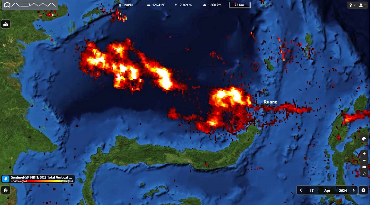
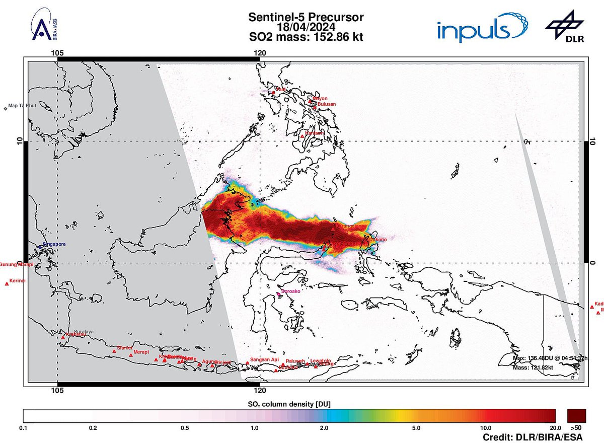
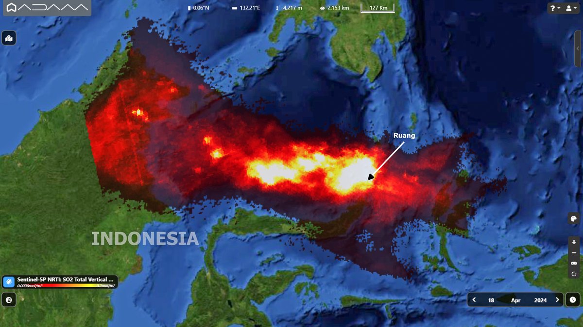
The SO2 plume from the new #eruption of #ruangvolcano is more than 1000 km long.
The #Copernicus #Sentinel5p #tropomi detected the sulfur dioxide emissisions on April 18th moving over #Indonesia .
#volcano #AirQuality
MAGMA Indonesia PENDAKI JAKARTA 🇮🇩 INFOMITIGASI Mike Masco

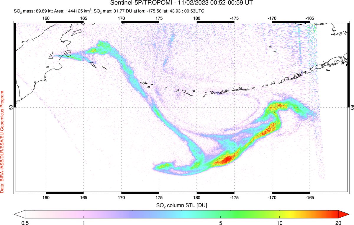
An #eruption of #Klyuchevskoy ( #Kamchatka , #Russia ), Eurasia's highest active #volcano , has spread SO₂ & ash over the North Pacific. #Sentinel5P #TROPOMI detects ~0.1 Tg SO₂ on Nov 2; Klyuchevskoy's largest eruption since 1994 but well below the threshold for #climate impacts.

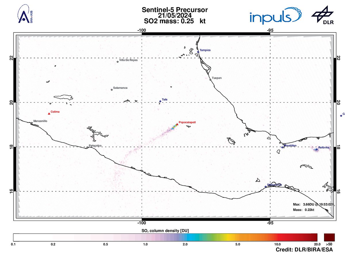
On 2024-05-21 #TROPOMI has detected an enhanced SO2 signal of 3.66DU at a distance of 20.0km to #Popocatepetl . #DLR_inpuls TROPOMI #S5p #Sentinel5p DLR - English BIRA-IASB ESA Earth Observation #SO2LH

The eruption, after 20 years, of the #Ruang #Volcano in #Indonesia from space. #Sangihe
The #Copernicus #Sentinel5p #tropomi detected on April 17th the SO2 plume.
MAGMA Indonesia PENDAKI JAKARTA 🇮🇩 INFOMITIGASI
