Weatherman Uttam(@Gujarat_weather) 's Twitter Profile Photo

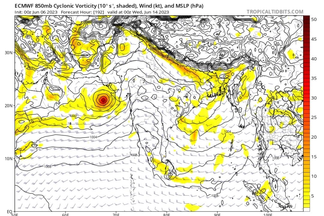
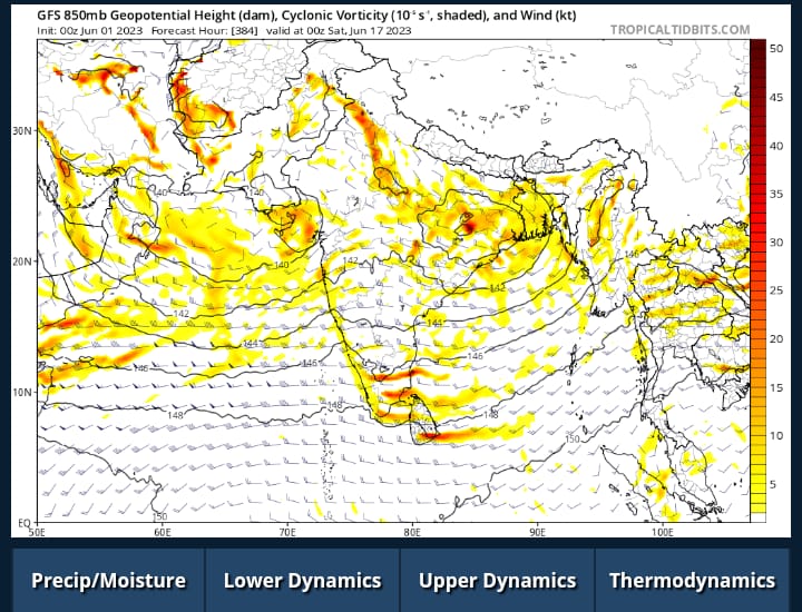
As per the latest update of and , the ecm model is moving northwest and approaching the coast of and appearing as a depression over .

(N/1)

As per the latest update of #ecm and #gfs, the ecm model is moving northwest and approaching the coast of #Saurashtra and appearing as a depression over #Kutch.

(N/1)
account_circle
Mumbai Nowcast(@MumbaiNowcast) 's Twitter Profile Photo

Cyclone Alert⚠️
LPA to form in Arabian sea by 7th June and it will gain strength to become .It will run parallel to the west coast and will head towards and finally towards West side.1st Heavy rains expected around 9/10 June in Mumbai⚠️ Stay Tuned

account_circle
Athreya Shetty🇮🇳(@shetty_athreya) 's Twitter Profile Photo

Personal opinion (40% confidence)-

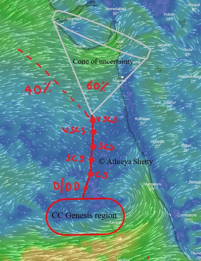
likely to form arnd ~Jun 7. Will move NNE parallel to the west coast initially, then uncertain if it goes NE towards or NW towards
60% chances landfall in Maha or Guj betn Jun 9-11

2/2

Personal opinion (40% confidence)-

#CycloneBiparjoy likely to form arnd #Lakshadweep ~Jun 7. Will move NNE parallel to the west coast initially, then uncertain if it goes NE towards #konkan or NW towards #Saurashtra #Gujarat
60% chances landfall in Maha or Guj betn Jun 9-11

2/2
account_circle
Mit(@drmjp93) 's Twitter Profile Photo

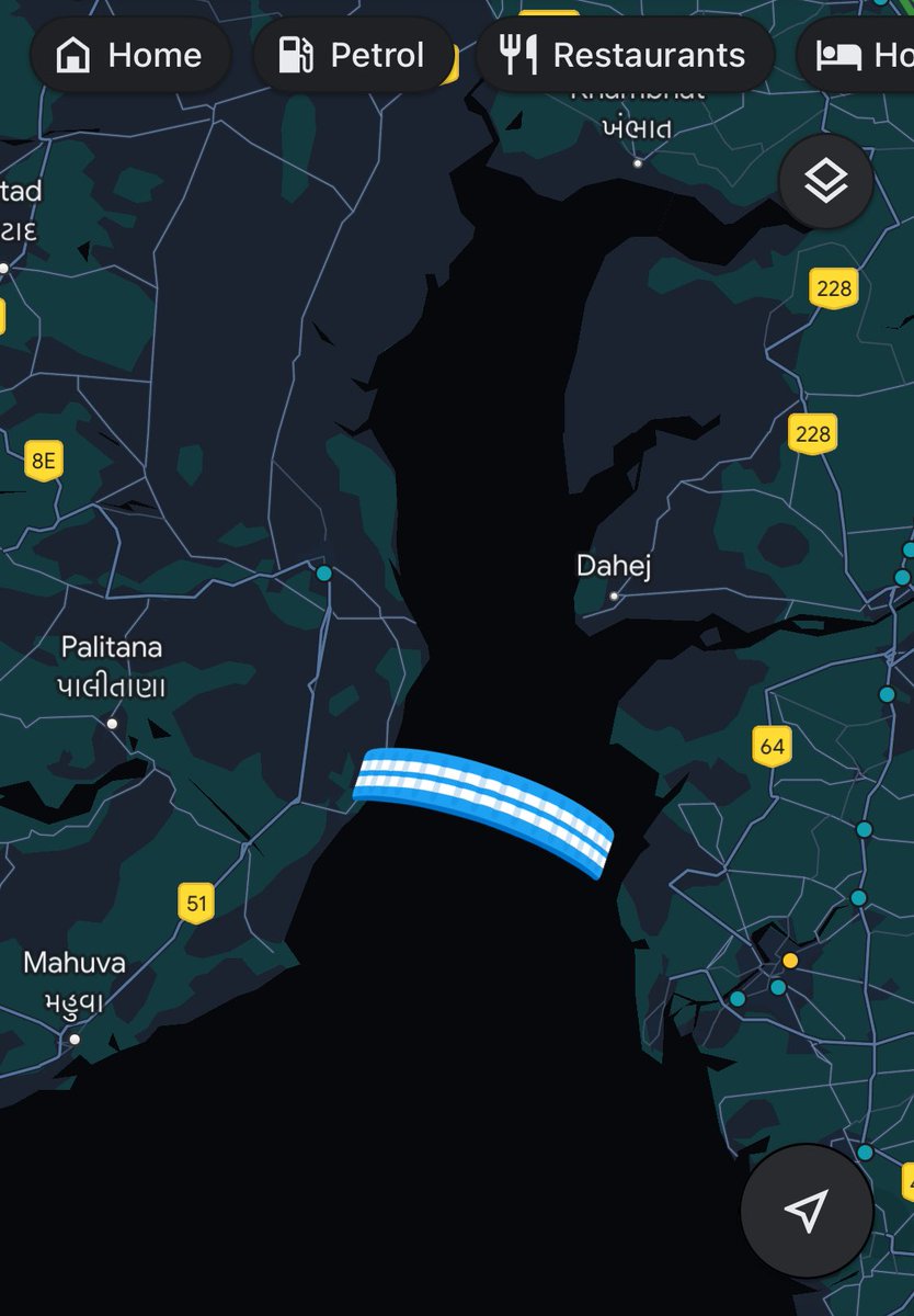
This ~60 kms bridge between Bhavnagar and Surat is not getting permission due to 'Parivaran' Team. But they are not seeing transport cost between 60kms vs 360kms.

If this happens saurashtra can be uplifted too quick when connected to Surat.

This ~60 kms bridge between Bhavnagar and Surat is not getting permission due to 'Parivaran' Team. But they are not seeing transport cost between 60kms vs 360kms. 

If this happens saurashtra can be uplifted too quick when connected to Surat.
account_circle
WeatherMet(@WeatherMaXX) 's Twitter Profile Photo

Latest ECMWF and GFS models are showing that will make landfall around Mumbai. 80% chances are of saurashtra also. North Konkan and Gujarat coastal areas need to keep a watch and prepare for large scale evacuation of that is the case. This will be clear in 2 day

Latest ECMWF and GFS models are showing that #cyclonebiprajoy will make landfall around Mumbai. 80% chances are of saurashtra  also. North Konkan and Gujarat coastal areas need to keep a watch and prepare for large scale evacuation of that is the case. This will be clear in 2 day
account_circle
Athreya Shetty🇮🇳(@shetty_athreya) 's Twitter Profile Photo

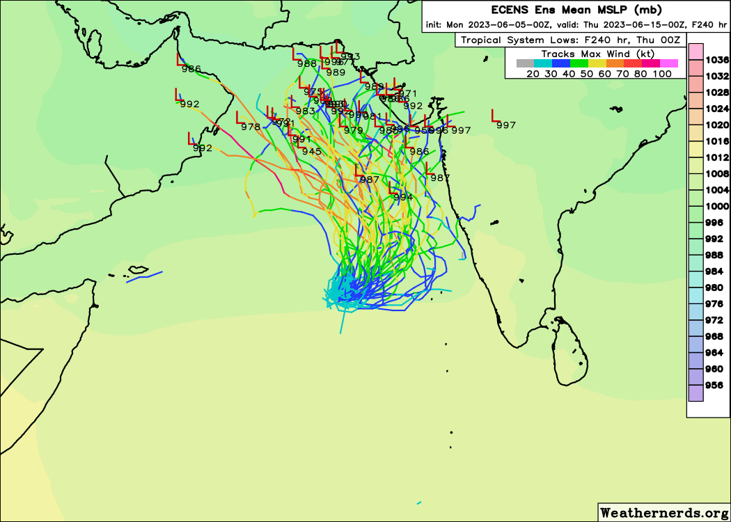
Need to continue to stay alert N and region ⚠️👀
Have been warning about this, if anything latest ensemble trends show tracks converging much closer to west coast now so need to keep a close eye.

Need to continue to stay alert N #konkan and #Saurashtra region ⚠️👀
Have been warning about this, if anything latest ensemble trends show tracks converging much closer to west coast now so need to keep a close eye.
#MumbaiRains
account_circle
Parth....(@Parth_GPT) 's Twitter Profile Photo

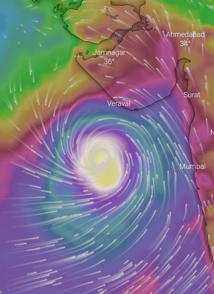
Till Today Evening Ecmwf model was showing Landfall at Maharashtra's Ratnagiri

It Has Changed Again To Gujarat's Saurashtra
215KM of Max Gusts😮

Still We Are At Early Stage To Accurately Predict The Path
Looks Like It Will Boost The

Till Today Evening Ecmwf model was showing #cyclonebiparjoy Landfall at Maharashtra's Ratnagiri

It Has Changed Again To Gujarat's Saurashtra 
215KM of Max Gusts😮

Still We Are At Early Stage To Accurately Predict The Path
Looks Like It Will Boost The #sw #monsoon 
#MumbaiRains
account_circle
Weatherman Uttam(@Gujarat_weather) 's Twitter Profile Photo

In the latest update of gfs and ecm, the is predicted to form in the Arabian sea and move towards the north-west, with the cyclone expected to make landfall on the coast.

Note :There is a possibility of change in which track information will be updated daily

In the latest update of gfs and ecm, the #cyclone is predicted to form in the Arabian sea and move towards the north-west, with the cyclone expected to make landfall on the #Saurashtra coast.

Note :There is a possibility of change in which track information will be updated daily
account_circle
Nordace(@NordaceOfficial) 's Twitter Profile Photo

Over 1 000 000 backpacks sold! What makes Nordace Siena so special?
✅Unique packsmart system
✅Protects your gear, valuables, cards and identity
✅Matches any style and comes in 9 colors

Time for stress-free travels has come and it starts with Nordace Siena

account_circle
Weatherman Uttam(@Gujarat_weather) 's Twitter Profile Photo

According to the latest update of and , the is moving north west and gfs landfall is seen in on west coast and ecm is passing the system close to coast.

If there is a change in this track, information about it will be given

account_circle
Weatherman Uttam(@Gujarat_weather) 's Twitter Profile Photo

(N1/2)

As per new update of and model in Arabian sea
A is likely to move north-west and make landfall as a storm along the coast.

There is a 60 Percentg chance of the system hitting the coast of Saurashtra.

account_circle