UK Ag Weather Center(@UKAGweather) 's Twitter Profileg
UK Ag Weather Center

@UKAGweather

ID:135929684

linkhttp://weather.uky.edu calendar_today22-04-2010 15:31:57

3,3K Tweets

716 Followers

103 Following

University of Kentucky Martin-Gatton CAFE(@UKAgriculture) 's Twitter Profile Photo

How about that weather we're having?

Be prepared for weather—and small talk—with our new app, 'Weather Alert.'

Learn more >> bit.ly/3KskEoY

iOS download >> apple.co/4bBGAKl.

Android download >> bit.ly/3yCv6rE

How about that weather we're having? Be prepared for weather—and small talk—with our new app, 'Weather Alert.' Learn more >> bit.ly/3KskEoY iOS download >> apple.co/4bBGAKl. Android download >> bit.ly/3yCv6rE
account_circle
NWS Louisville(@NWSLouisville) 's Twitter Profile Photo

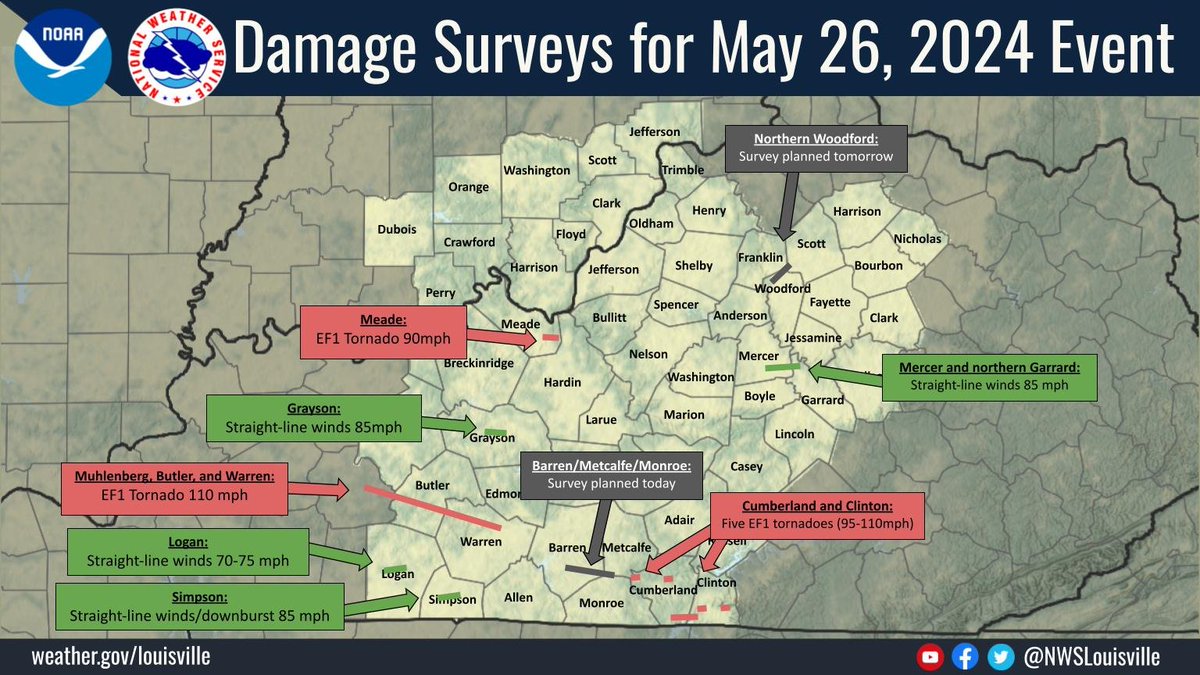
📌(Updated 5/30/24 at 12 PM EDT) Damage survey crews continue assessing damage from the May 26th, 2024 Event.
Information will be updated as new survey results are determined.
The survey team determined five EF1 tornadoes in Cumberland and Clinton Counties.

📌(Updated 5/30/24 at 12 PM EDT) Damage survey crews continue assessing damage from the May 26th, 2024 Event. Information will be updated as new survey results are determined. The survey team determined five EF1 tornadoes in Cumberland and Clinton Counties. #kywx #inwx
account_circle
NWS Paducah, KY(@NWSPaducah) 's Twitter Profile Photo

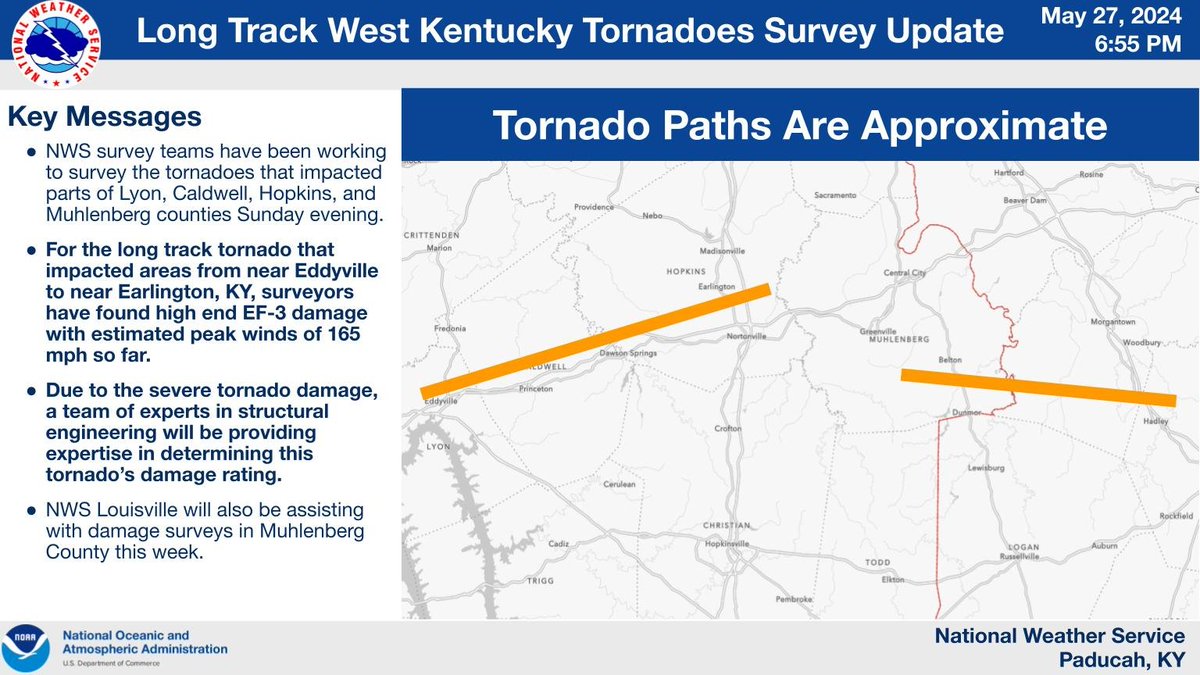
A survey team from NWS Paducah has found high end EF-3 damage so far from the long track tornado that impacted areas from near Eddyville to near Earlington, KY. Due to the severe damage, structural engineering experts will be providing assistance with rating this tornado.

A survey team from NWS Paducah has found high end EF-3 damage so far from the long track tornado that impacted areas from near Eddyville to near Earlington, KY. Due to the severe damage, structural engineering experts will be providing assistance with rating this tornado.
account_circle
NWS Paducah, KY(@NWSPaducah) 's Twitter Profile Photo

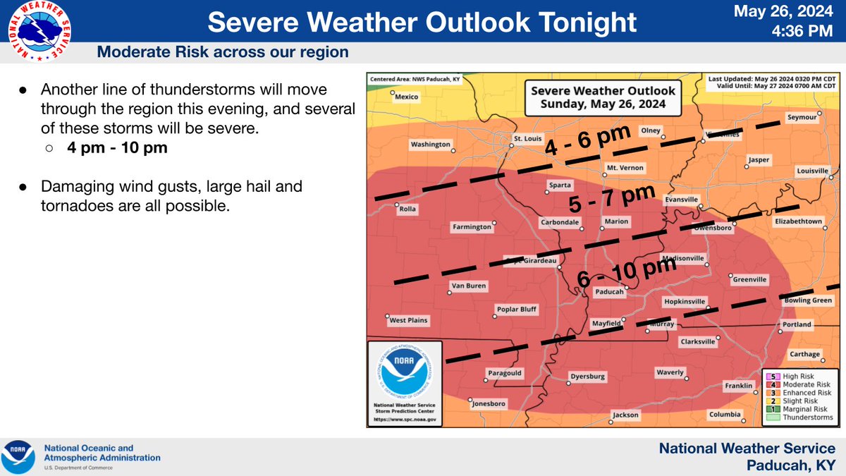
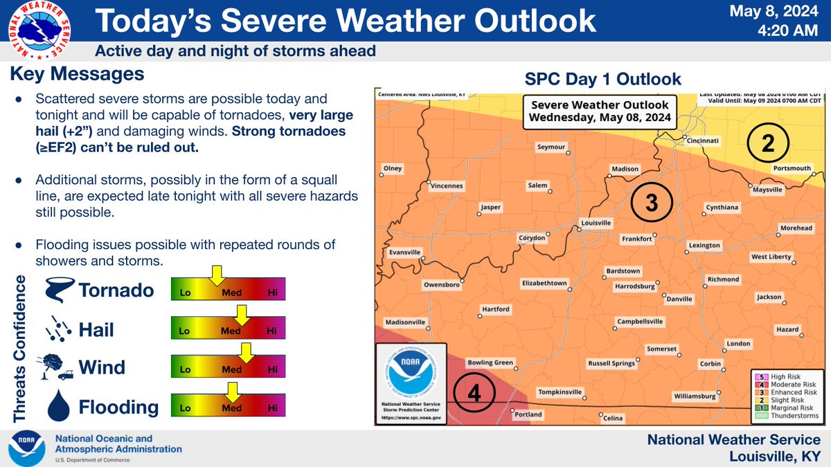
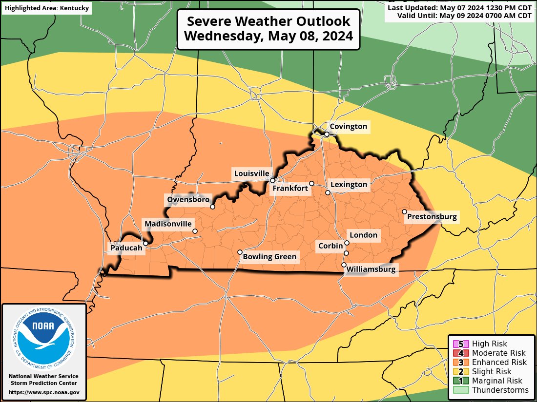
A look at the severe weather outlook, timing estimate along with the severe weather threat this afternoon into this evening. All severe threats are possible, damaging winds (hurricane force), very large hail, strong tornadoes and significant flash flooding.

A look at the severe weather outlook, timing estimate along with the severe weather threat this afternoon into this evening. All severe threats are possible, damaging winds (hurricane force), very large hail, strong tornadoes and significant flash flooding.
account_circle
NWS Storm Prediction Center(@NWSSPC) 's Twitter Profile Photo

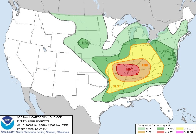
3:22pm CDT Day1 Outlook Moderate Risk: across south-central and southeast Missouri, far northeast Arkansas, southern Illinois, far southwest Indiana, western Kentucky, and northwest Tennessee. spc.noaa.gov/products/outlo…

3:22pm CDT #SPC Day1 Outlook Moderate Risk: across south-central and southeast Missouri, far northeast Arkansas, southern Illinois, far southwest Indiana, western Kentucky, and northwest Tennessee. spc.noaa.gov/products/outlo…
account_circle
Kentucky Mesonet(@kymesonet) 's Twitter Profile Photo

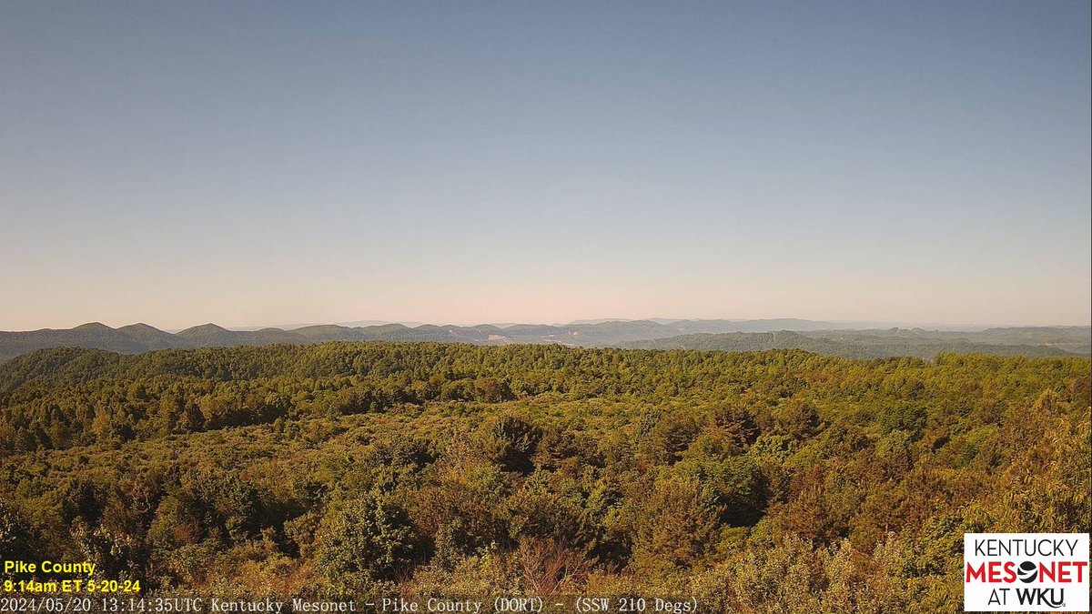
The week is off to a gorgeous start across the state. Blue skies with just a big of high cloud cover are evident on our cameras in N Fayette Co. at the UK Ag Weather Center Spindletop Farm and in Fulton Co. to the W. In the E mountains, a bit of haze is showing up in S Pike Co.

The week is off to a gorgeous start across the state. Blue skies with just a big of high cloud cover are evident on our cameras in N Fayette Co. at the @UKAGweather Spindletop Farm and in Fulton Co. to the W. In the E mountains, a bit of haze is showing up in S Pike Co. #kywx
account_circle
NWS Louisville(@NWSLouisville) 's Twitter Profile Photo

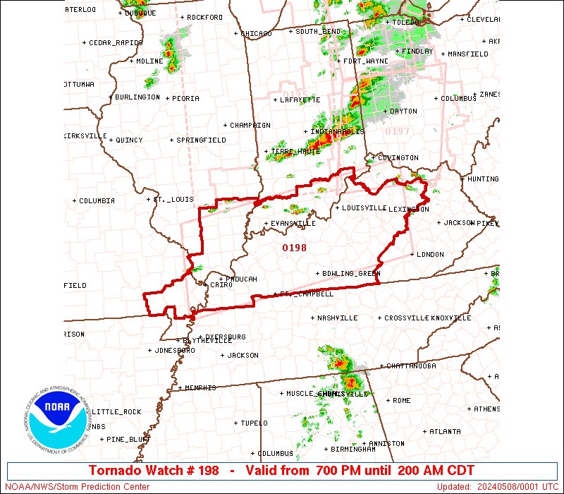
More storms are expected today and tonight. Large hail, damaging winds, tornadoes, and flooding are all possible. Stay weather aware!

More storms are expected today and tonight. Large hail, damaging winds, tornadoes, and flooding are all possible. Stay weather aware! #kywx #inwx
account_circle
NWS Paducah, KY(@NWSPaducah) 's Twitter Profile Photo

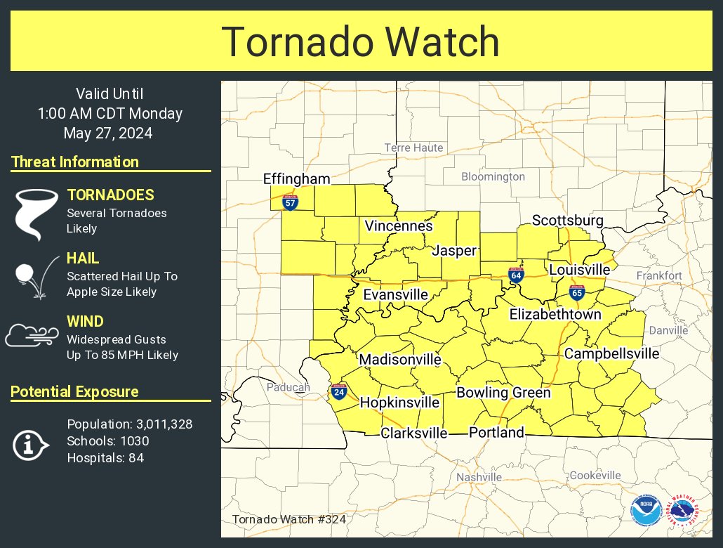
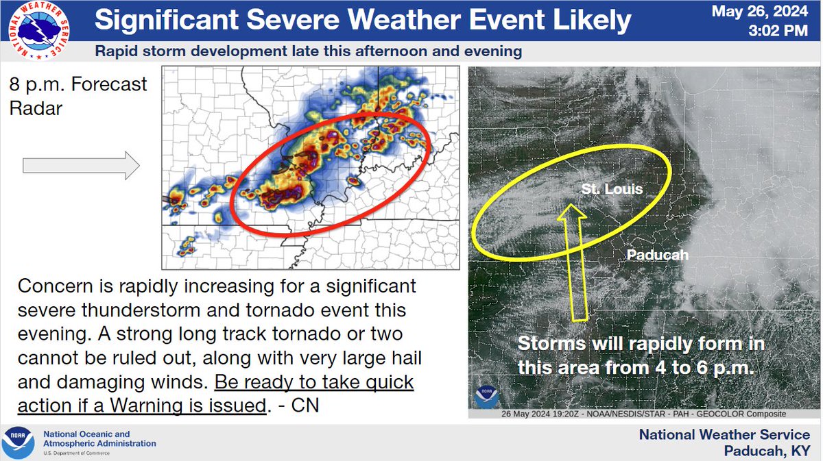
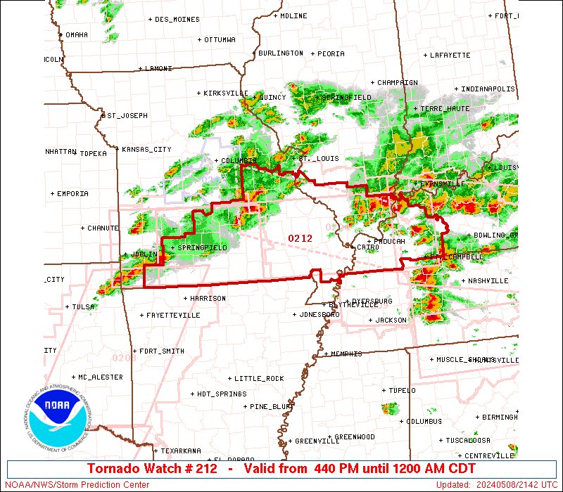
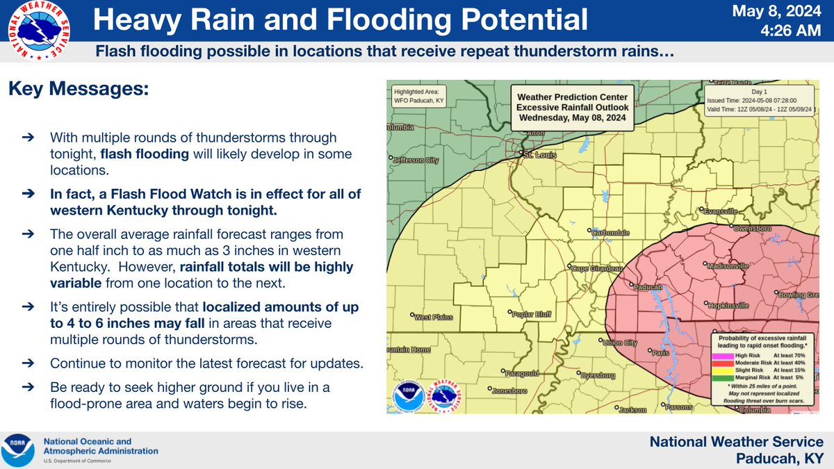
An outbreak of severe thunderstorms and tornadoes is possible through tonight. All modes of severe weather, including damaging winds, large hail, and tornadoes, will be possible. Flash flooding is also likely where thunderstorms train over the same locations.

An outbreak of severe thunderstorms and tornadoes is possible through tonight. All modes of severe weather, including damaging winds, large hail, and tornadoes, will be possible. Flash flooding is also likely where thunderstorms train over the same locations.
account_circle
UK Ag Weather Center(@UKAGweather) 's Twitter Profile Photo

More severe weather on the table for KY over the next 36 hours. Are you prepared? Do you have multiple ways to receive warning? Consider downloading the UK Ag Weather Center's new app, 'Weather Alert'! Ad-free!

More info on the app/download: conta.cc/4aaUphe

More severe weather on the table for KY over the next 36 hours. Are you prepared? Do you have multiple ways to receive warning? Consider downloading the UK Ag Weather Center's new app, 'Weather Alert'! Ad-free! #kywx More info on the app/download: conta.cc/4aaUphe
account_circle
NWS Storm Prediction Center(@NWSSPC) 's Twitter Profile Photo

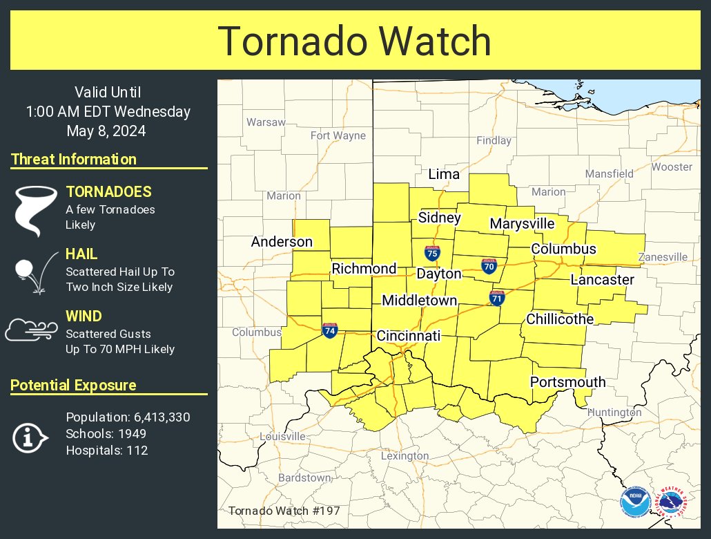
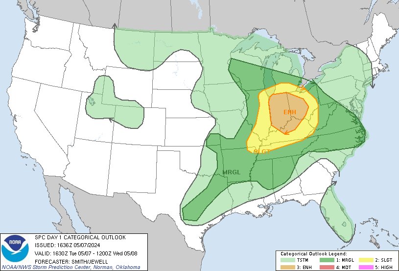
11:38am CDT Day1 Outlook Enhanced Risk: for Indiana, western and central Ohio, and northern Kentucky spc.noaa.gov/products/outlo…

11:38am CDT #SPC Day1 Outlook Enhanced Risk: for Indiana, western and central Ohio, and northern Kentucky spc.noaa.gov/products/outlo…
account_circle
KY Climate Center(@KYClimate) 's Twitter Profile Photo

THU morning update shows more of SE KY in D0 (abnormally dry). Further discussion TODAY with Dr. Jerry Brotzge in our Drought Early Warning webinar at 2pm ET/1pm CT. Please join us! Zoom link: 📷wku.zoom.us/j/99406376503
YouTube Channel: 📷youtube.com/channel/UCDg3h… UK Ag Weather Center

account_circle
KY Climate Center(@KYClimate) 's Twitter Profile Photo

🧵Happy week everyone! A reminder to join us this THU (May 2nd) at 2pm ET / 1pm CT - as state climatologist & WKU Ogden College professor Dr. Jerry Brotzge takes us through a look back at April, current conditions, ag impacts, & outlooks, followed by a time for Q & A.

🧵Happy #KentuckyDerby150 week everyone! A reminder to join us this THU (May 2nd) at 2pm ET / 1pm CT - as state climatologist & @wkuogden professor Dr. Jerry Brotzge takes us through a look back at April, current conditions, ag impacts, & outlooks, followed by a time for Q & A.
account_circle
KY Climate Center(@KYClimate) 's Twitter Profile Photo

Did Monday's frost (and freeze, for some) cause damage to the Kentucky's wheat crop? This article has more: kygrains.info/blog/2024/4/23… UK Ag Weather Center

account_circle