Pete Delkus(@wfaaweather) 's Twitter Profileg
Pete Delkus

@wfaaweather

I'm just your weather guy.

ID:15937025

linkhttps://www.wfaa.com/article/about-us/team-bios/pete-delkus/287-28580021 calendar_today21-08-2008 21:15:45

73,8K Tweets

456,0K Followers

153 Following

Follow People
Pete Delkus(@wfaaweather) 's Twitter Profile Photo

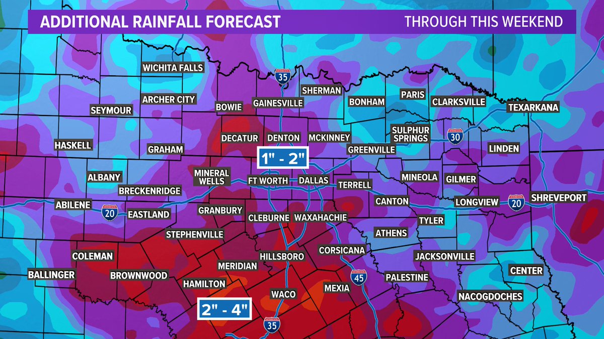
An additional 1'-4' of rain across North Texas through this weekend. The ground is holding about as much as it can, so any periods of heavy rain could cause isolated flash flooding.

An additional 1'-4' of rain across North Texas through this weekend. The ground is holding about as much as it can, so any periods of heavy rain could cause isolated flash flooding. #wfaaweather
account_circle
Jobin Panicker(@jobinpnews) 's Twitter Profile Photo

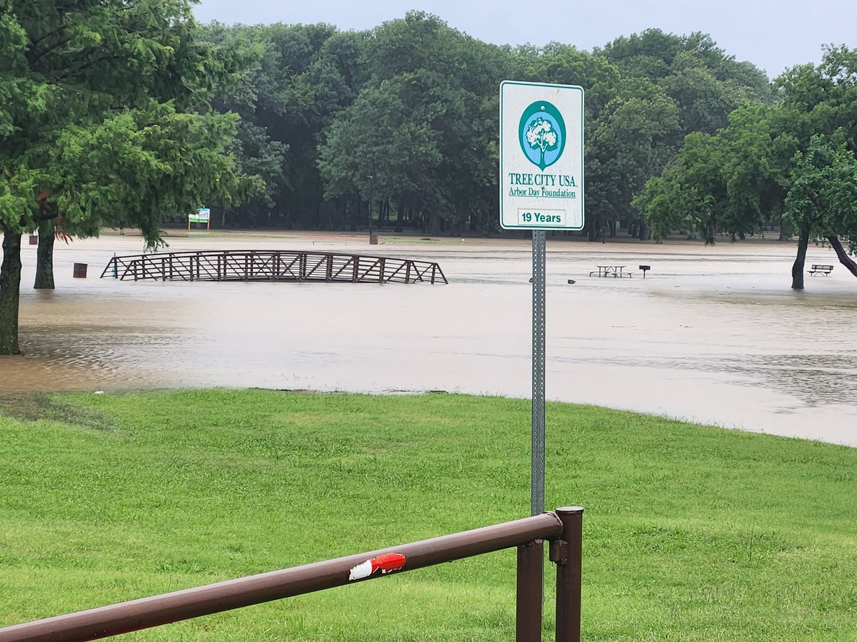
The flooding at Towne Lake Park in McKinney. One of three parks closed in the city due to high water. Turn around, don't drown! WFAA WFAAweather

#NOW The flooding at Towne Lake Park in McKinney. One of three parks closed in the city due to high water. Turn around, don't drown! @wfaa @wfaaweather
account_circle
Pete Delkus(@wfaaweather) 's Twitter Profile Photo

A bit of a break coming in now for the metroplex. The heaviest rain is pushing to the southeast, and most of the evening will be dry for the Dallas-Fort Worth area. Flash Flood Warnings will continue through the afternoon.

account_circle
WFAA(@wfaa) 's Twitter Profile Photo

FLASH FLOODING: Our crew is seeing high water along White Rock Creek near I-635 (LBJ) in North Dallas

Latest North Texas flooding updates: wfaa.com/article/news/l…

account_circle
WFAA(@wfaa) 's Twitter Profile Photo

Storms continue to move through North Texas today. A viewer sent us this video of a lightning strike near Maple Avenue and Medical District Drive in Dallas.

Latest flooding updates: wfaa.com/article/news/l…

Video via Dan Shaw

account_circle
Pete Delkus(@wfaaweather) 's Twitter Profile Photo

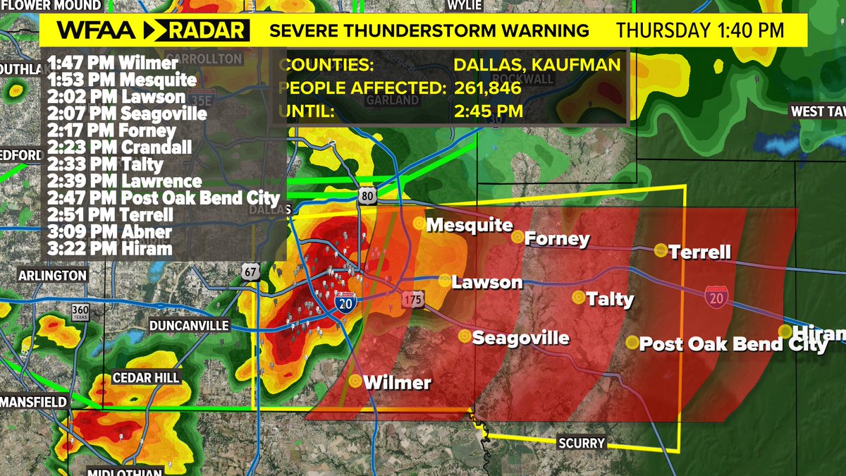
Severe thunderstorm warning Dallas and Kaufman County. Hail up to the size of quarters and damaging winds up to 60 MPH possible. The flash flooding threat continues for all of the metroplex.

Severe thunderstorm warning Dallas and Kaufman County. Hail up to the size of quarters and damaging winds up to 60 MPH possible. The flash flooding threat continues for all of the metroplex. #wfaaweather
account_circle
WFAA(@wfaa) 's Twitter Profile Photo

LIVE UPDATES: We're tracking heavy rain and flash flooding across North Texas this afternoon

Live coverage: wfaa.com/article/news/l…

account_circle
WFAA(@wfaa) 's Twitter Profile Photo

FLASH FLOODING: We're seeing numerous reports of flash flooding and high water across DFW

Latest updates and radar: wfaa.com/article/news/l…

account_circle
Pete Delkus(@wfaaweather) 's Twitter Profile Photo

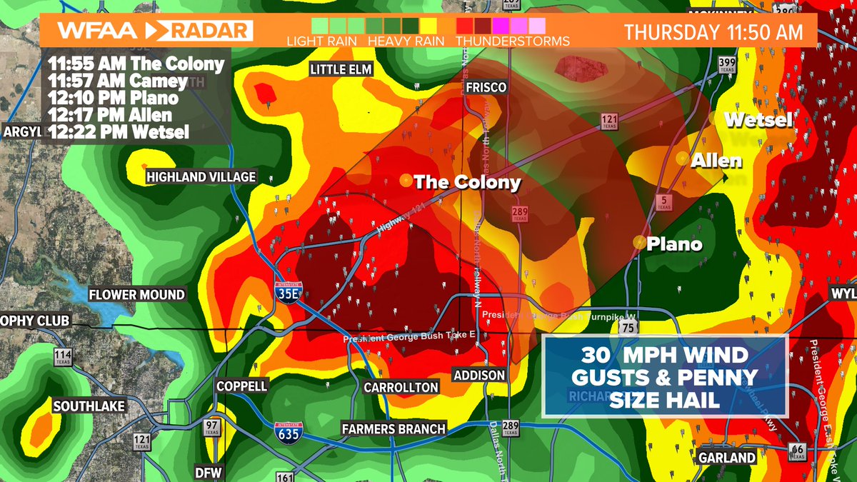
Lewisville & The Colony - Watching a storm over you that could be producing penny size hail and 30 mph wind gusts. It is moving northeast at 30 mph.

Lewisville & The Colony - Watching a storm over you that could be producing penny size hail and 30 mph wind gusts. It is moving northeast at 30 mph. #wfaaweather
account_circle
Pete Delkus(@wfaaweather) 's Twitter Profile Photo

FLASH FLOOD WARNING now includes parts of North Dallas County in addition to Collin County until 2pm. Storms have produced over 1.5 inches of rain with an additional 1-1.5 inches possible. Avoid flooded roads!
wfaa.com/radar

account_circle
Pete Delkus(@wfaaweather) 's Twitter Profile Photo

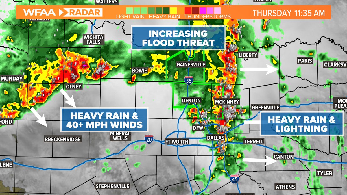
11:35am: Non-severe storms in DFW will move east with heavy rain and 30 mph wind gusts. The flood concern along Red River counties continues for 1-2 hours. Watching more storms to the NW with more heavy rain & 40 mph wind gusts. Storms will continue through early PM

11:35am: Non-severe storms in DFW will move east with heavy rain and 30 mph wind gusts. The flood concern along Red River counties continues for 1-2 hours. Watching more storms to the NW with more heavy rain & 40 mph wind gusts. Storms will continue through early PM #wfaaweather
account_circle
Pete Delkus(@wfaaweather) 's Twitter Profile Photo

FLASH FLOOD WARNING in place for Denton and Collin County until 2pm. Storms have already produced 1 to 1.5 inches of rain with an additional 1-2 inches of rain on the way. Avoid flooded roads!

account_circle