Txomin Hermosilla(@txominhermos) 's Twitter Profileg
Txomin Hermosilla

@txominhermos

Remote Sensing Research Scientist. Cartographer.
Canadian Forest Service @PFC_CFS, Natural Resources Canada @NRCan 

ID:1907867646

calendar_today26-09-2013 13:26:22

3,2K Tweets

2,0K Followers

1,7K Following

Dr Robbi Bishop-Taylor 🛰️🌎🌊(@SatelliteSci) 's Twitter Profile Photo

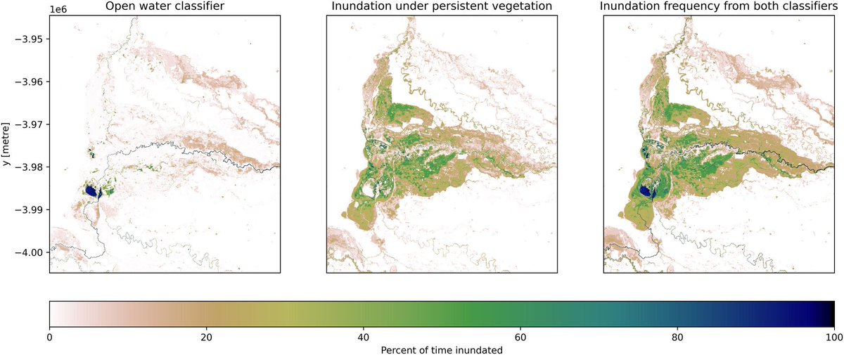
A super neat new paper from leo lymburner, providing a new method for mapping innundation *under* forest canopy using and satellite data! 🛰️🌳💧
onlinelibrary.wiley.com/doi/10.1002/hy…

A super neat new paper from @lymburner74, providing a new method for mapping innundation *under* forest canopy using #Landsat and #Sentinel2 satellite data! 🛰️🌳💧 onlinelibrary.wiley.com/doi/10.1002/hy…
account_circle
Dr. Joanne C. White(@Joanne_C_White) 's Twitter Profile Photo

Harmonizing multi-temporal airborne laser scanning point clouds to derive periodic annual height increments in temperate mixedwood forests cdnsciencepub.com/doi/10.1139/cj…

account_circle
Mike Wulder(@mikewulder) 's Twitter Profile Photo

Science and products related to forest , species, structure (e.g. , height, volume, canopy cover), as well as annual change by key disturbance type ( , harvesting; since 1984).
List of pubs: researchgate.net/publication/35…
Data: opendata.nfis.org/mapserver/nfis…
account_circle
Mike Wulder(@mikewulder) 's Twitter Profile Photo

Culminating multiple decades of research, with accelerating capacity for large area implementation and product development over the last decade, we have implemented a national forest monitoring system for Canada:
The National Terrestrial Ecosystem Monitoring System ( ).🌲🇨🇦

Culminating multiple decades of research, with accelerating capacity for large area implementation and product development over the last decade, we have implemented a national forest monitoring system for Canada: The National Terrestrial Ecosystem Monitoring System (#NTEMS).🌲🇨🇦
account_circle
Fabian Fassnacht(@FabianFassnach1) 's Twitter Profile Photo

Forest practitioners really appreciate canopy height models for numerous tasks related to forest management. We asked practitioners in which rhythm they require new canopy height information and at what spatial scale. You can find their replies here: tinyurl.com/INSANEfff

Forest practitioners really appreciate canopy height models for numerous tasks related to forest management. We asked practitioners in which rhythm they require new canopy height information and at what spatial scale. You can find their replies here: tinyurl.com/INSANEfff
account_circle
USGS EROS(@USGS_EROS) 's Twitter Profile Photo

Celebrate two decades of in 2024! This milestone year brings the LANDFIRE 2023 Update, an improved product suite that includes a truly annual update and two new products that will enable faster . Learn more here: ow.ly/S2nW50RRSkc
Celebrate two decades of #LANDFIRE in 2024! This milestone year brings the LANDFIRE 2023 Update, an improved product suite that includes a truly annual update and two new #LandDisturbance products that will enable faster #DataDelivery. Learn more here: ow.ly/S2nW50RRSkc
account_circle
Maartje Korver(@maartjekorver) 's Twitter Profile Photo

The first chapter of my PhD research has been published!🥳We present LakeTEMP: a dataset of 8 surface water temperature observations and ice phenology estimations for all lakes in the world that are larger than 0.1 km² (~1.4 million).🧵 sciencedirect.com/science/articl…

account_circle
Fabian Fassnacht(@FabianFassnach1) 's Twitter Profile Photo

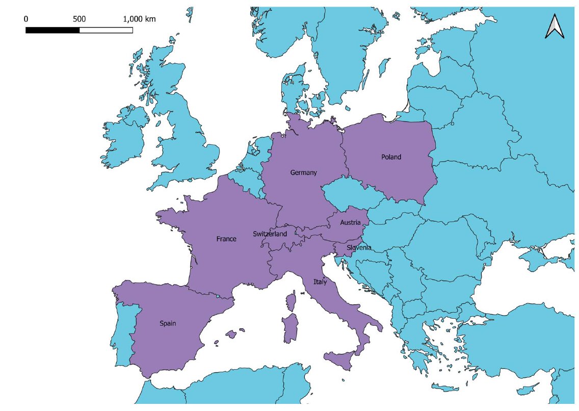
Late results from our INSANE project. We used a questionnaire survey to ask forest practitioners across central and southern Europe (see map) concerning their expectations for remote sensing based forest information products. It is a long one again ;-) tinyurl.com/INSANEfff

Late results from our INSANE project. We used a questionnaire survey to ask forest practitioners across central and southern Europe (see map) concerning their expectations for remote sensing based forest information products. It is a long one again ;-) tinyurl.com/INSANEfff
account_circle
Mike Wulder(@mikewulder) 's Twitter Profile Photo

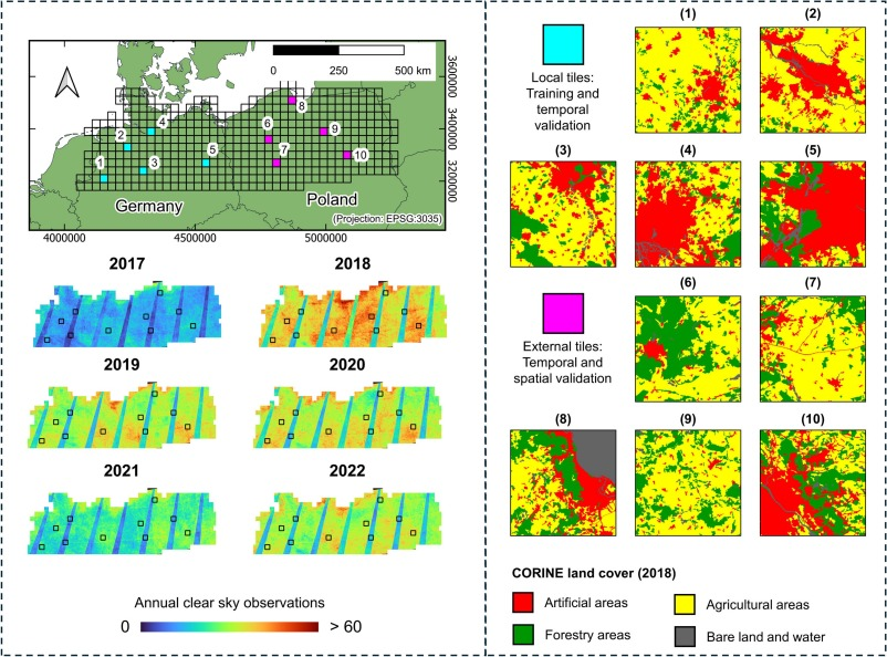
'Specifically, models trained in years with high data density performed well in that same year but poorly when transferred to years with lower density.'
Pham et al. Learning the variations in annual spectral-temporal metrics to enhance the transferability of regression models for

'Specifically, models trained in years with high data density performed well in that same year but poorly when transferred to years with lower density.' Pham et al. Learning the variations in annual spectral-temporal metrics to enhance the transferability of regression models for
account_circle
Mike Wulder(@mikewulder) 's Twitter Profile Photo

'Data providers need to understand that remote sensing products must offer added value to foresters’ work & not only a map of what foresters already know'
Forest practitioners’ requirements for remote sensing-based canopy height, wood-volume, tree species & disturbance products👇

account_circle
Hankui Zhang(@Hankui_K_Zhang) 's Twitter Profile Photo

Still use logistic/harmonic to model time series reflectance? Check our new self-supervised learning for interpolation (SSLI) (shorturl.at/djJP0) uses ChatGPT style training, i.e., masked out some words (observed reflectance) in sentences (time series) for supervision.

Still use logistic/harmonic to model time series reflectance? Check our new self-supervised learning for interpolation (SSLI) (shorturl.at/djJP0) uses ChatGPT style training, i.e., masked out some words (observed reflectance) in sentences (time series) for supervision.
account_circle
Terry Sunderland(@TCHSunderland) 's Twitter Profile Photo

Exciting opportunity: New post doc position in the Sunderland Lab UBC Forestry for research on African mangroves: ubc.wd10.myworkdayjobs.com/en-US/ubcfacul…
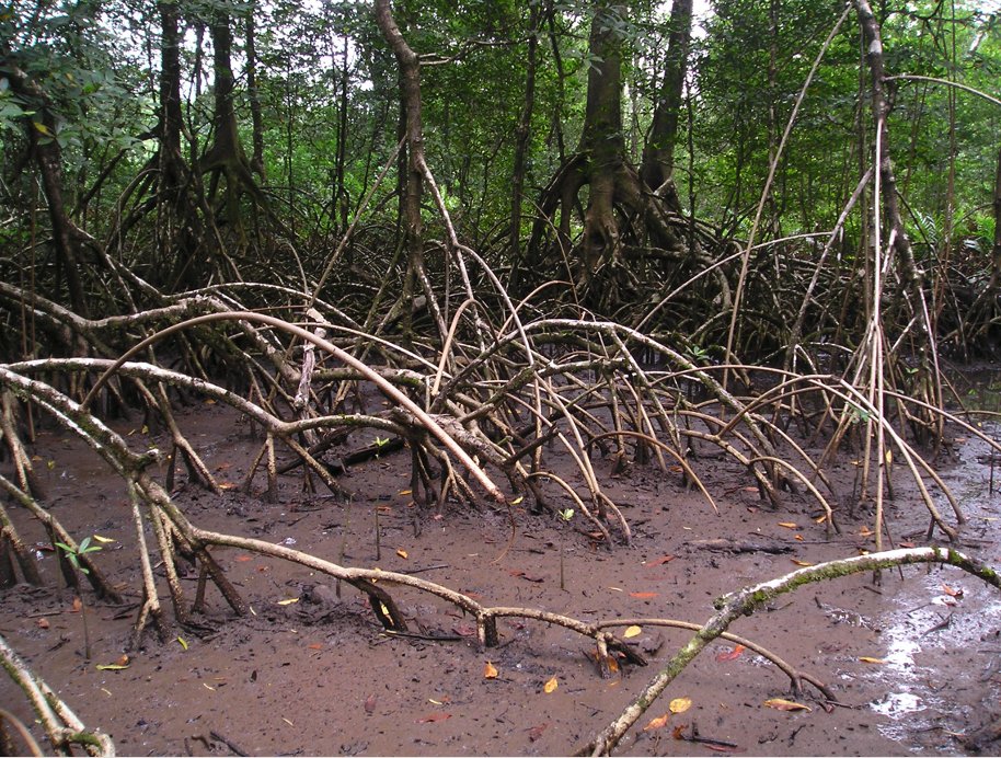
Exciting opportunity: New post doc position in the @sunderland_lab @ubcforestry for research on African mangroves: ubc.wd10.myworkdayjobs.com/en-US/ubcfacul…
account_circle
Lisa Mandl(@_lisamandl) 's Twitter Profile Photo

Forest recovery success or failure? Remote sensing can help answer this question. Take a look at our new RSE paper: doi.org/10.1016/j.rse.…
Big thanks to my amazing co-authors Alba Viana Soto , Ana Stritih , Rupert Seidl and especially Cornelius Senf for the great support!
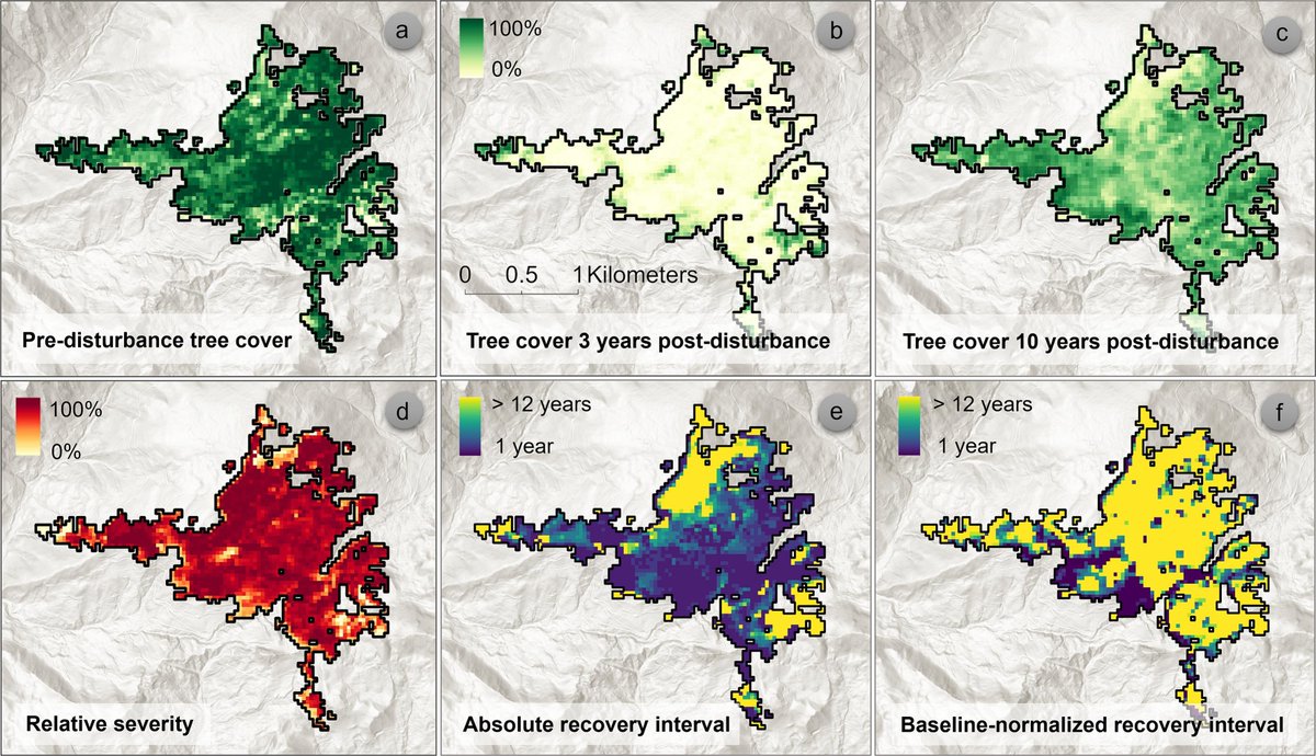
Forest recovery success or failure? Remote sensing can help answer this question. Take a look at our new RSE paper: doi.org/10.1016/j.rse.… Big thanks to my amazing co-authors @albaa_vs , @AnaStritih , @RupertSeidl and especially @corneliussenf for the great support!
account_circle
Mike Wulder(@mikewulder) 's Twitter Profile Photo

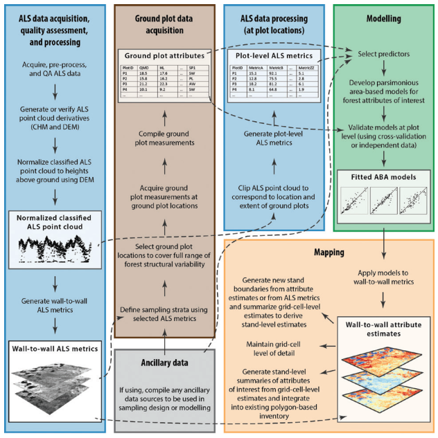
You have airborne , now what to do? 🌲📏
Find guidance:
Dr. Joanne C. White et al. A model development and application guide for generating an enhanced forest inventory using airborne laser scanning data and an area-based approach.
🔗publications.gc.ca/collections/co…

You have airborne #lidar, now what to do? 🌲📏 Find guidance: @Joanne_C_White et al. A model development and application guide for generating an enhanced forest inventory using airborne laser scanning data and an area-based approach. #forestinventory 🔗publications.gc.ca/collections/co…
account_circle
Mike Wulder(@mikewulder) 's Twitter Profile Photo

New classification approaches robust to missing data. 👇👇
Che et al. Linearly interpolating missing values in time series helps little for land cover classification using recurrent or attention networks.

🔗sciencedirect.com/science/articl…

New #deeplearning #landcover classification approaches robust to missing data. 👇👇 Che et al. Linearly interpolating missing values in time series helps little for land cover classification using recurrent or attention networks. #Landsat #Sentinel2 #HLS 🔗sciencedirect.com/science/articl…
account_circle
Heather Reese(@RRs4es) 's Twitter Profile Photo

📢 Do you want to do a using satellite data to observe climate influences on tundra vegetation in Sweden? With me, Robert Björk and Alison Beamish, Göteborgs universitet / University of Gothenburg APE@GU. Apply by 9 June - more info here: tinyurl.com/4m7s57ua
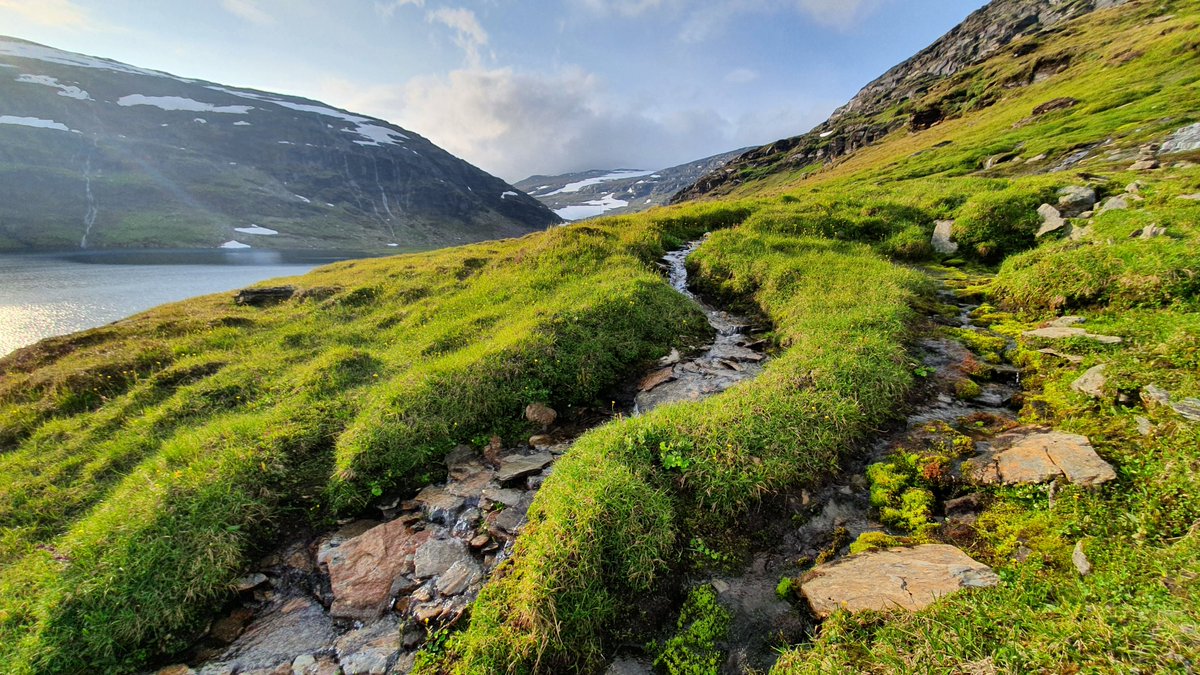
📢 Do you want to do a #PhD using #hyperspectral satellite data to observe climate influences on tundra vegetation in Sweden? With me, @RobertGBjork and @Ali_Beamish, @goteborgsuni @APEGU1. Apply by 9 June - more info here: tinyurl.com/4m7s57ua
account_circle
Cornelius Senf(@corneliussenf) 's Twitter Profile Photo

We reviewed the use the resilience concepts in the field of Earth observation. Greatly led by Sebastian Bathiany! Check out the full paper (including beautiful hand-drawn figures) here: doi.org/10.1007/s10712…

We reviewed the use the resilience concepts in the field of Earth observation. Greatly led by @TheRealBathiany! Check out the full paper (including beautiful hand-drawn figures) here: doi.org/10.1007/s10712…
account_circle
Mike Wulder(@mikewulder) 's Twitter Profile Photo

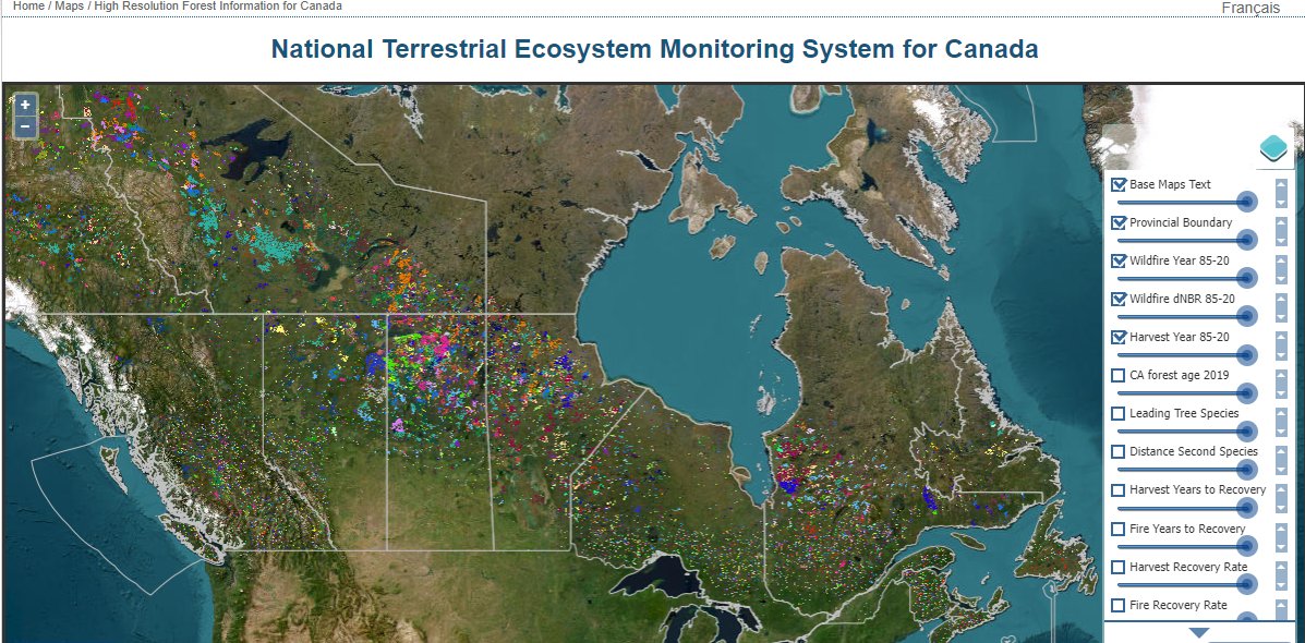
Need detailed data for modeling or an investigation of Canada's wildfire situation? 🔥🌲🇨🇦
See: Pre-existing , estimates of & canopy cover, historic and harvesting, species, age, plus burn severity of historic fires. Plus spatially exhaustive forest

account_circle